-
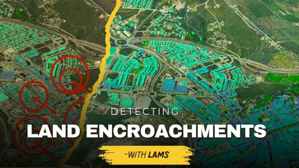
Detecting Unauthorized Structures and Encroachments on Your Land with LAMS
Land is one of the most valuable assets for individuals, businesses, and government bodies. However, protecting it from unauthorized structures, encroachments, and illegal occupation continues to be a major challenge. Traditional monitoring methods often fail to provide real-time, accurate insights—leading to disputes, financial losses, and even legal complications. This is where land acquisition and management system (LAMS) plays a crucial role. By integrating GIS-based land management solutions with advanced digital tools, LAMS empowers landowners and organizations to identify, monitor, and prevent encroachments effectively. Why Detecting Unauthorized Structures & Encroachments Is Important Prevents Financial Losses – Encroachments reduce the usable value of your land, affecting long-term revenue and development potential. Reduces Legal Disputes – Unauthorized construction often…
-
Smart Real Estate Management in 2025: How GIS and MIS Are Transforming Land Administration
The real estate industry is undergoing a major transformation in 2025, driven by digitalization, automation, and data-driven decision-making. With urbanization accelerating and real estate markets becoming more complex, traditional land management methods face significant challenges. Challenges in Traditional Land Management: Manual Record-Keeping: Paper-based property records are prone to errors, duplication, and loss. Fraud and Ownership Disputes: Lack of transparency in property transactions leads to legal disputes and fraud. Inefficiencies in Land Use Planning: Poor data management results in suboptimal zoning, environmental risks, and delayed development projects. To address these challenges, Geographic Information Systems (GIS) and Management Information Systems (MIS) are revolutionizing land administration by providing real-time data, automation, and predictive analytics. These technologies…
CyberSWIFT
Solutions With Innovative Future Technology