GIS
-
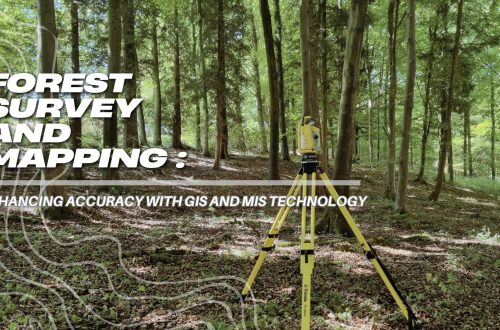
Forest Survey and Mapping: Enhancing Accuracy with GIS and MIS Technology
Forest survey and mapping play a crucial role in environmental conservation, resource management, and biodiversity protection. Traditional methods of surveying forests relied on manual data collection, which was often time-consuming and prone to errors. However, with the advent of modern technologies like Geographic Information System (GIS) and Management Information System (MIS), forest mapping has become more efficient, accurate, and scalable. These tools help in monitoring forest health, land-use planning, and policy-making. In this blog, we will explore how GIS and MIS enhance forest survey and mapping, their key features, challenges, and future scope. The Role of GIS in Forest Survey and Mapping 1. Geospatial Data Collection GIS allows for the…
-
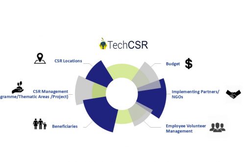
Geo-Targeting Goodness: The Synergy Between GIS and Corporate Social Responsibility
Corporate Social Responsibility refers to the practices and policies undertaken by organisations to have a positive impact on the world.
-
Manage Land-related Legal Disputes Through the Legal & Court Case Management Module on LAMS
In the realm of legal proceedings, the complexity of land-related litigation demands efficient and organized management. As the legal landscape evolves, so do the tools available to legal professionals. Enter the realm of legal and court case management modules, which have emerged as indispensable assets for streamlining land-related litigation processes. This blog delves into the transformative impact of these applications on land-related litigation and explores their key features, benefits, and future potential. The Complexity of Land-Related Litigation: Our land software (LAMS) has a court case module that encompasses a diverse array of cases, ranging from property disputes to zoning issues and environmental concerns. The multifaceted nature of these cases necessitates…
-
Advantages of AI and GIS-Driven Compensatory Land Allocation System
The allocation of land resources plays a pivotal role in shaping societies and economies. In recent years, the integration of Artificial Intelligence (AI) and Geographic Information Systems (GIS) into land allocation software has ushered in a new era of efficiency and precision. This blog delves into the advantages of AI and GIS-driven compensatory land allocation software, highlighting how it streamlines the land allocation process, enhances decision-making, and promotes sustainable land management. Enhanced Decision-Making: AI and GIS-driven land allocation software empowers decision-makers with robust analytical tools. By processing vast datasets and applying advanced algorithms, land software can provide invaluable insights into land characteristics, topography, soil quality, and environmental factors. These insights…
-
How Does a GIS-based Project Monitoring System Help in Road Construction Management?
A GIS (Geographic Information System) based project monitoring software can significantly enhance road construction monitoring management by leveraging geospatial data and analysis. Here are some ways in which GIS-based software helps in road construction management: Site Selection and Planning: GIS allows project managers to analyze various geographical factors such as terrain, soil types, land use, and environmental considerations. This aids in selecting suitable road construction sites and optimizing the project’s route and alignment. Data Integration: GIS-based software can integrate various data sources, including satellite imagery, drone surveys, LiDAR data, and ground-level data, into a single platform. This comprehensive dataset provides a holistic view of the project area and assists in…
-
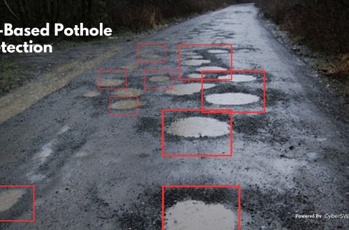
AI-Based Pothole Detection for Enhanced Road Safety
Potholes are a major safety hazard on roads. They can cause damage to vehicles, lead to accidents, and even injure or kill people. Traditional methods of pothole detection, such as manual inspection and visual surveys, are time-consuming and labor-intensive. They can also be inaccurate, especially in large or remote areas. AI-based pothole detection is a promising new technology that can help to improve road safety. These systems use cameras, sensors, and machine learning algorithms to automatically detect and identify potholes. It can be deployed in a variety of ways, including: Fixed Cameras: Fixed cameras can be installed at strategic locations along roads to monitor for potholes. These cameras can send alerts…
-
Discover The Importance of Land Software in Land-Related Litigation Cases
Land management software plays a crucial role in managing land-related litigation cases. Here are some key points on the importance of Litigation management software in such cases: Efficient Case Management: Land dispute cases involve a large amount of documentation and paperwork. Land management software helps streamline case management by organizing and storing documents, tracking deadlines, and managing court dates. This ensures that all the relevant information is easily accessible, improving efficiency and reducing the chances of errors or missed deadlines. Centralized Information: Land-related litigation cases or land dispute cases often involve multiple parties, complex legal issues, and voluminous data. Litigation management software provides a centralized platform to store and access all the relevant information,…
-
Revolutionizing Land Management with Land Information Management Systems
Land is an essential resource that is finite in nature, and its management is crucial for ensuring its sustainable use. The traditional methods of land management are often plagued by inefficiencies, corruption, and a lack of transparency, which can result in land disputes and mismanagement. Land Information Management Systems (LIMS) have the potential to revolutionize land management by bringing transparency, efficiency, and equity to the system. What is Land Information Management System (LIMS)? A Land Information Management System (LIMS) is a GIS-based digital platform used to manage land-related data, such as ownership, use, value, and location. It is an integrated system that enables the efficient collection, storage, retrieval, analysis, and…
-
Top 10 Benefits of a GIS-Based Project Monitoring System
What is a Project Monitoring System? A GIS-based project monitoring system uses geographic information systems (GIS) technology to track and manage the progress of a project. This type of system allows users to view and analyze project data in a geographic context, such as mapping project locations and displaying information about project milestones and timelines. It also allows users to share the data with other stakeholders in a project, such as project managers, engineers, and government officials. This system can be used for a wide range of projects, including infrastructure development, natural resource management, and urban planning. Benefits of Using a Project Monitoring System: 1. Spatial Visualization: GIS-based project monitoring systems allow…
-
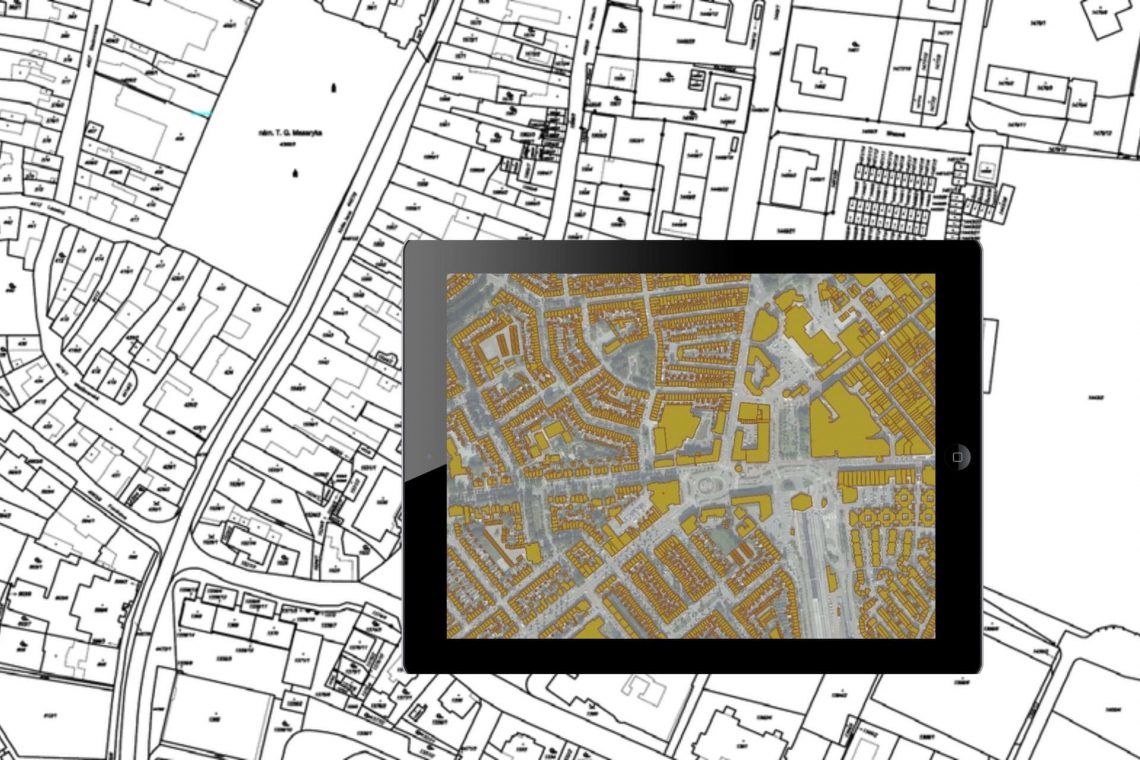
Land Records Management System Using GIS Technology
Introduction: In India, land ownership is primarily established through a registered sale deed (a record of the property transaction between the buyer and seller). Other documents used to establish ownership include the record of rights (document with details of the property), property tax receipts, and survey documents. Land records consist of various types of information (property maps, sale deeds) and are maintained across different departments at the district or village level. These departments work in silos, and the data across departments is not updated properly. Hence, discrepancies are often noted in land records. The district administration keeps land records to determine who owns and where the borders of a piece…