How Does a GIS-based Project Monitoring System Help in Road Construction Management?
A GIS (Geographic Information System) based project monitoring software can significantly enhance road construction monitoring management by leveraging geospatial data and analysis. Here are some ways in which GIS-based software helps in road construction management:
Site Selection and Planning: GIS allows project managers to analyze various geographical factors such as terrain, soil types, land use, and environmental considerations. This aids in selecting suitable road construction sites and optimizing the project’s route and alignment.
Data Integration: GIS-based software can integrate various data sources, including satellite imagery, drone surveys, LiDAR data, and ground-level data, into a single platform. This comprehensive dataset provides a holistic view of the project area and assists in making informed decisions.
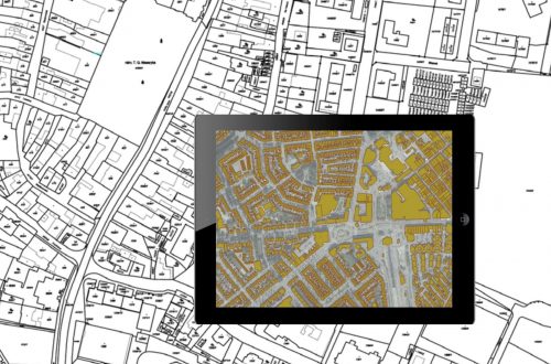
Project Visualization: GIS provides powerful visualization tools like 3D models and interactive maps to represent the road construction project. This visual representation helps stakeholders understand the project’s scope and potential impacts better.
Utility Mapping: GIS can incorporate utility infrastructure data, such as water pipelines, electric lines, and underground cables, to avoid conflicts during construction. This minimizes the risk of damaging existing utilities and ensures safety during construction.

Environmental Impact Assessment: GIS-based software facilitates environmental impact assessments by overlaying road construction plans with sensitive ecological areas, wildlife habitats, and protected zones. This allows project managers to implement measures to minimize environmental impacts.
Real-Time Progress Tracking: GIS-based project monitoring software can track construction progress in real-time using GPS data from construction equipment and vehicles. Project managers can monitor work completed, track resources, and identify any delays.
Risk Analysis: GIS enables the identification and analysis of potential risks and hazards associated with the construction project. By assessing factors like proximity to flood-prone areas or geological instability, project managers can proactively address risks.
Resource Management: GIS can help optimize resource allocation by analyzing factors such as material sources, transportation routes, and storage locations. Efficient resource management leads to cost savings and streamlined construction processes.
Stakeholder Collaboration: GIS-based platforms offer a centralized hub for project data and facilitate collaboration among various stakeholders, including contractors, engineers, and government agencies. This streamlines communication and ensures everyone stays informed.
Post-Construction Asset Management: After the road is constructed, GIS can be used for ongoing asset management, including maintenance and repair scheduling. GIS-based asset management helps prolong the road’s lifespan and reduces long-term costs.
Overall, Project Progress Monitoring System (PPMS) is a GIS-based project monitoring software that empowers road construction monitoring management with data-driven decision-making, efficient planning, and better coordination among all parties involved. It enhances project efficiency, reduces risks, and contributes to the successful completion of road construction projects.

Currently heading the Business Development at CyberSWIFT, Dip is a Creative, Collaborative, Solution-Oriented Technologist, who is passionate about providing a Win/ Win situation to both Client and Company. With 10+ years of experience in the IT & Geospatial Industry, he has been in different shoes at different times viz. Strategic Business Development, Direct Sales, Project Management, Solution Architect, etc.


