-
A GIS-Based Approach to Road Condition Monitoring and Pothole Detection using AI
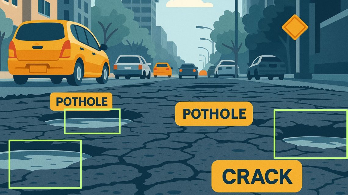
Maintaining road infrastructure is a critical responsibility for urban and rural authorities alike. Roads with potholes, cracks, and surface deterioration not only affect vehicle performance but also pose significant safety risks. A systematic and technology-enabled approach is essential for improving road conditions, optimizing road maintenance efforts, and ensuring timely project completion. This is where AI-based road condition monitoring systems come into play. They provide spatial intelligence, visual analytics, and data-driven insights that can significantly improve how road infrastructure is built and maintained. Understanding Road Condition Monitoring Systems A road condition monitoring system is a comprehensive framework that continuously assesses the health of road infrastructure. It combines with field data to…
-
How Does a GIS-based Project Monitoring System Help in Road Construction Management?
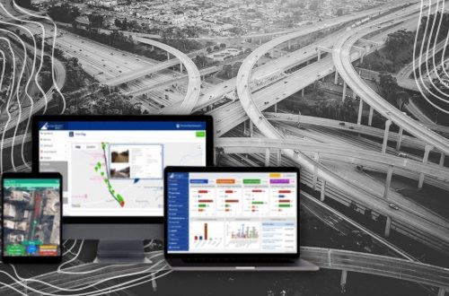
A GIS (Geographic Information System) based project monitoring software can significantly enhance road construction monitoring management by leveraging geospatial data and analysis. Here are some ways in which GIS-based software helps in road construction management: Site Selection and Planning: GIS allows project managers to analyze various geographical factors such as terrain, soil types, land use, and environmental considerations. This aids in selecting suitable road construction sites and optimizing the project’s route and alignment. Data Integration: GIS-based software can integrate various data sources, including satellite imagery, drone surveys, LiDAR data, and ground-level data, into a single platform. This comprehensive dataset provides a holistic view of the project area and assists in…
CyberSWIFT
Solutions With Innovative Future Technology