-
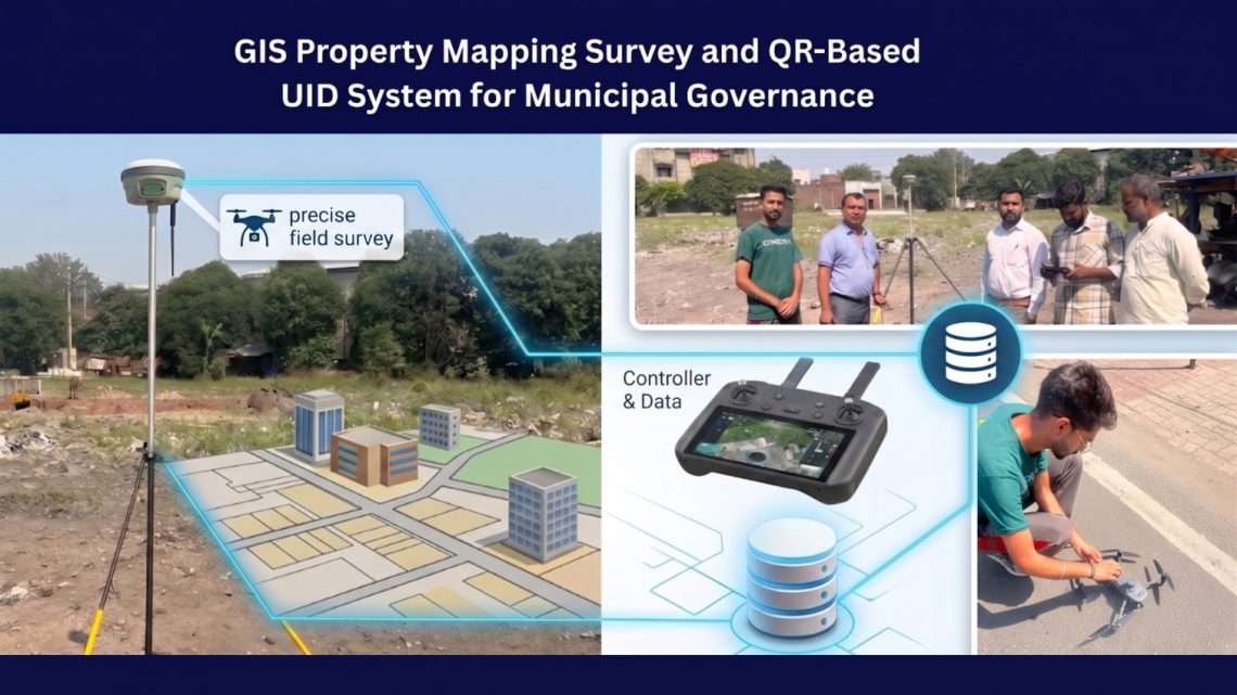
GIS Property Mapping Survey and QR-Based UID System for Municipal Governance: A Complete Digital Transformation Framework
Urban local bodies across India and many developing regions are facing increasing pressure to modernize property administration, improve tax collection efficiency, and build transparent governance systems. Traditional municipal property management methods — often dependent on outdated records, paper-based surveys, and fragmented databases — are no longer capable of supporting rapidly growing urban environments. To address these challenges, modern municipalities are adopting GIS-based property mapping systems integrated with QR-enabled digital property identification. These technologies help local governments establish accurate property databases, streamline taxation processes, improve urban planning, and enhance citizen services. This blog explores how a comprehensive GIS Property Mapping Survey and QR-Based Unique Property Identification System can transform municipal governance…
-
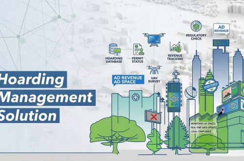
Hoarding Management Solution with GIS & UAV | Smart Billboard Monitoring System
Hoardings or billboards play a crucial role in urban advertising and information dissemination. However, unregulated hoardings can lead to visual clutter, safety hazards, and loss of revenue for municipal authorities. A Hoarding Management Solution (HMS) provides a systematic approach to managing, regulating, and monitoring hoardings using Geographic Information Systems (GIS), UAV technology, and digital databases. Objectives of Hoarding Management Solution Inventory Creation: Maintain a digital record of all hoardings, including location, dimensions, ownership, and permit status. Regulatory Compliance: Ensure adherence to municipal and legal norms for hoarding placement. Revenue Optimization: Track and manage advertising revenues through proper licensing and fee collection. Safety and Aesthetics: Prevent unauthorized or hazardous hoardings that…
-
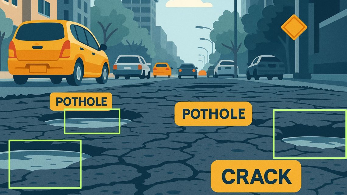
AI Based Road Condition Monitoring System: Transforming Infrastructure Management
Road infrastructure is a vital component of urban and rural connectivity. However, maintaining roads in good condition is a constant challenge due to factors such as weather, traffic load, and natural wear and tear. Traditional road inspection methods are often time-consuming, labour-intensive, and prone to human error. An AI-based Road Condition Monitoring System leverages artificial intelligence, computer vision, and geospatial technologies to automate road inspections, enhance maintenance efficiency, and improve transportation safety. Objectives of AI-Based Road Condition Monitoring Automated Road Inspection: Reduce manual efforts by using AI and machine learning to detect road defects. Real-Time Condition Assessment: Provide up-to-date information on road quality. Efficient Maintenance Planning: Prioritize road repairs based on severity and location. Cost Optimization: Reduce…
-
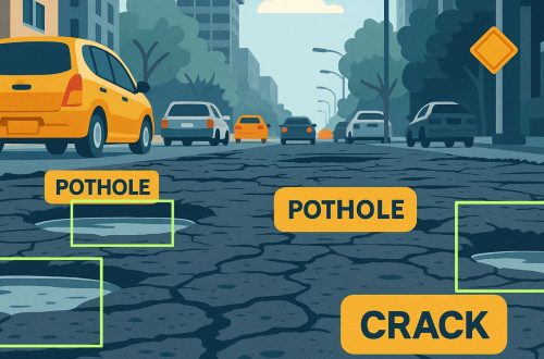
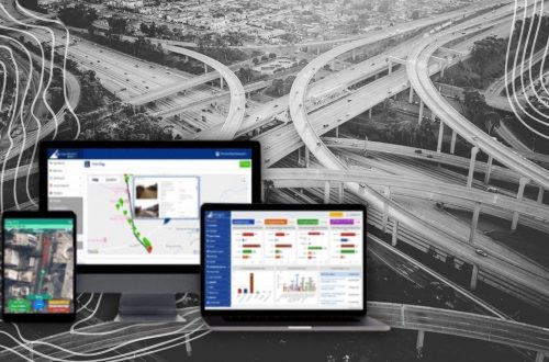
A GIS-Based Approach to Road Condition Monitoring and Pothole Detection using AI
Maintaining road infrastructure is a critical responsibility for urban and rural authorities alike. Roads with potholes, cracks, and surface deterioration not only affect vehicle performance but also pose significant safety risks. A systematic and technology-enabled approach is essential for improving road conditions, optimizing road maintenance efforts, and ensuring timely project completion. This is where AI-based road condition monitoring systems come into play. They provide spatial intelligence, visual analytics, and data-driven insights that can significantly improve how road infrastructure is built and maintained. Understanding Road Condition Monitoring Systems A road condition monitoring system is a comprehensive framework that continuously assesses the health of road infrastructure. It combines with field data to…
-
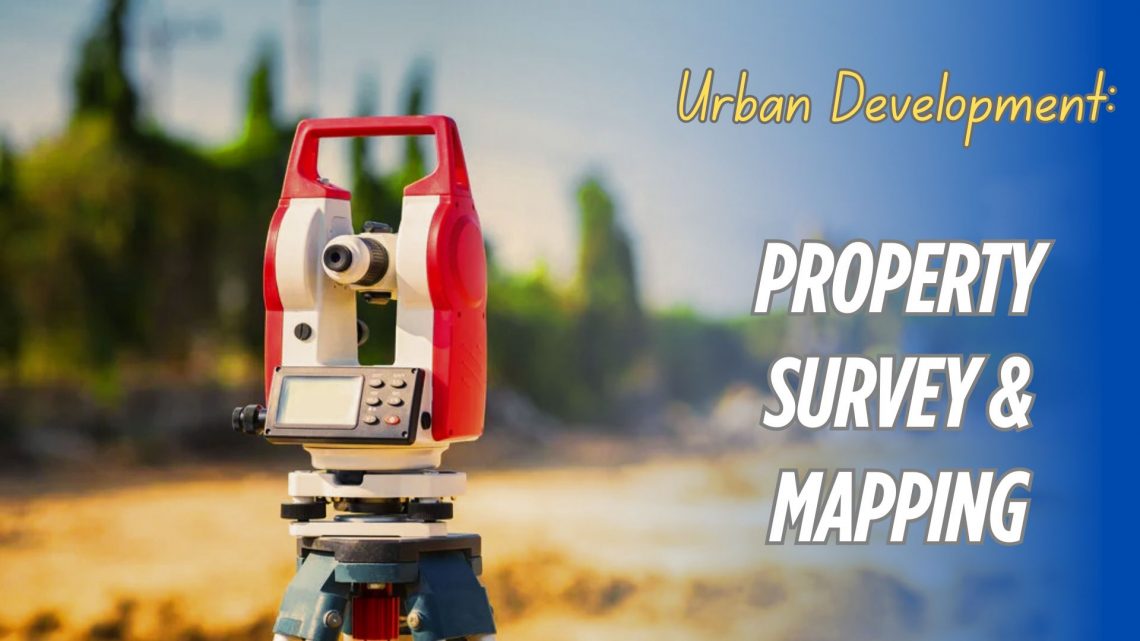
Urban Development Property Survey & Mapping: Powering Smart Cities with Precision
As cities continue to grow rapidly, efficient property administration and urban planning have become more crucial than ever. A property survey and mapping system acts as the foundation for sustainable urban development, facilitating everything from infrastructure planning to legal property ownership. By integrating cutting-edge technologies like Geographic Information Systems (GIS), Unmanned Aerial Vehicles (UAVs), and centralized digital property databases, municipalities and private developers can ensure accurate, transparent, and accessible property records. Let’s explore how this process works, why it’s essential, and how it’s shaping the future of smart cities. Why Property Survey & Mapping is Essential in Urban Development Inaccurate property boundaries, outdated property records, and unchecked encroachments have long hindered…
-
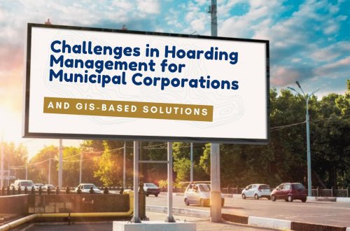
Challenges in Hoarding Management for Municipal Corporations and GIS-Based Solutions
Hoardings play a crucial role in urban advertising, generating substantial revenue for municipal corporations. However, managing these hoardings efficiently presents numerous challenges. Unauthorized hoardings, revenue leakages, and lack of proper monitoring mechanisms create inefficiencies in the system. The introduction of a Hoarding Management System integrated with GIS technology provides an innovative solution to these issues. Key Challenges in Hoarding Management 1. Identification of Potential Revenue Municipal corporations often struggle to assess the exact revenue that can be collected from hoardings. The disparity between actual and potential revenue arises due to unregistered hoardings and inefficiencies in tax collection. A Hoarding Management System enables authorities to track and assess the revenue potential more accurately.…
-
Challenges in Monitoring Road Infrastructure and GIS-Based Solutions
Road infrastructure is the backbone of a country’s economy, facilitating trade, transportation, and connectivity. However, maintaining and monitoring road conditions is a complex task due to various challenges such as wear and tear, weather conditions, increasing vehicular load, and lack of real-time data. Traditional road monitoring methods often rely on manual inspections, which are time-consuming, expensive, and prone to errors. The integration of Geographic Information Systems (GIS) into road infrastructure monitoring provides a more efficient, accurate, and cost-effective solution. AI-based Road Condition Monitoring Systems leverage advanced machine learning algorithms and computer vision to detect road damages such as potholes, cracks, and surface degradation in real-time. These systems enhance efficiency by automating…
-
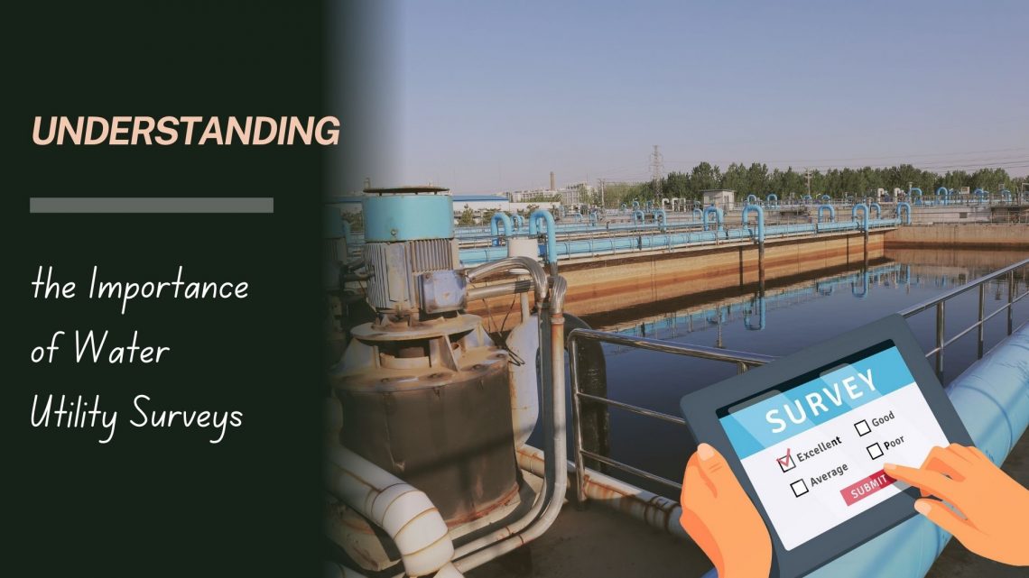
Understanding the Importance of Water Utility Surveys
Water is a fundamental resource that sustains life, and the infrastructure supporting its supply and distribution is a critical component of urban and rural development. A water utility survey plays a pivotal role in ensuring the efficient and sustainable management of water resources. This blog explores the concept of water utility surveys, their methodology, and the benefits they bring to communities and organizations. What Is a Water Utility Survey? A water utility survey is a comprehensive process of mapping, identifying, and analysing the infrastructure associated with water supply and distribution systems. This includes underground pipelines, storage tanks, pumping stations, valves, and other components. Utilizing advanced technologies such as Ground Penetrating Radar…
-
Road Condition Monitoring System(RCMS): Enhancing Efficiency with AI-Powered Solutions
The quality and sustainability of road infrastructure play a pivotal role in societal development, economic growth, and the safety of communities. To address the challenges of road construction and maintenance, advanced digital tools such as Road Condition Monitoring Systems (RCMS) are becoming indispensable. Leveraging technologies like AI-powered pothole detection, data analytics, and interactive visualization, RCMS ensures efficient planning, monitoring, and maintenance of road networks. In this blog, we will explore the features, benefits, and challenges of implementing an RCMS, with a focus on AI-driven solutions that improve the accuracy and efficiency of road construction and maintenance processes. What is a Road Condition Monitoring System? A Road Condition Monitoring System (RCMS) is a digital…
CyberSWIFT
Solutions With Innovative Future Technology