How to Cross-Check Land Boundaries with Government Records
Accurately verifying land boundaries is a crucial step in any land-related transaction—be it purchase, sale, lease, or development. Inaccurate or unclear boundaries can lead to legal disputes, financial losses, or project delays. One of the most effective ways to prevent such issues is by cross-checking land boundaries with official government records.
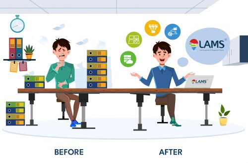
Thanks to technological advancements, especially in GIS-based land management systems and land records management systems, this process is now more efficient, accurate, and accessible than ever. In this blog, we explore the importance of cross-verifying land boundaries and the tools that simplify the process, such as land allotment software, land information management systems, and land lease management tools.
Why Cross-Checking Land Boundaries is Important
Before engaging in land-related transactions or developments, confirming the legal boundaries of the land ensures:
- Legal compliance and ownership clarity
- Avoidance of disputes with adjacent landowners
- Proper land utilization and zoning compliance
- Accurate valuation and taxation
- Lease Management
Cross-verifying land boundaries also ensures that the land parcel is free from encroachments or overlaps, which is essential for both public and private sector stakeholders.
How to Cross-Check Land Boundaries with Government Records: Step-by-Step
1. Obtain Official Land Records
The first step is to collect official land documents such as the Record of Rights (RoR), cadastral maps, survey records, and title deeds from the respective government offices or online portals. These documents serve as the legal foundation for verifying land boundaries.
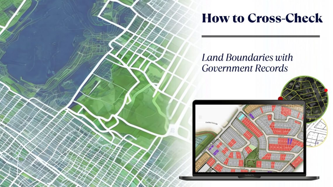
2. Access GIS-Based Government Portals
Many governments have digitized land records and provide GIS-based land records management portals for public access. These systems allow users to view the geospatial layout of land parcels, overlaid with official boundary data.
3. Use Land Mapping Software
Land mapping software enables users to compare the physical or surveyed map of the land with government-issued digital maps. Using satellite imagery, drone surveys, and GPS data, these tools offer a highly accurate boundary delineation, which can then be matched with official cadastral data.
Leveraging Technology for Accurate Verification
GIS-Based Land Management System
A GIS-based land management system integrates spatial data with land records, allowing users to visualize, analyze, and compare land boundaries efficiently. These systems provide access to boundary data, ownership information, and zoning regulations, all of which help in comprehensive cross-checking.
Land Information Management System
A land information management system centralizes all land-related data, including ownership records, lease agreements, allotment history, and land use patterns. It ensures that users can validate land boundaries while having access to a holistic view of the land parcel.
Land Allotment Software
Land allotment software automates the process of land allocation and tracks allotment history, ensuring that land boundaries are consistent with historical and legal records. It also helps avoid duplication or overlapping of land parcels.
Digital Land Management: The Future of Land Verification
In the digital era, digital land management systems are transforming how land boundaries are cross-checked and managed. These systems offer:
- Instant access to digitized records
- Automated alerts on discrepancies
- Integration with survey data for on-ground accuracy
- Manage land lease
With such systems, both government authorities and private stakeholders can ensure that every land boundary aligns with legal records, improving transparency and efficiency.
Recommended Read
What is Land Information Management System (LIMS)?
Key Benefits of Cross-Checking Land Boundaries with Technology
- Accurate Identification: Ensures that the land parcel matches legal documents and spatial data.
- Dispute Prevention: Reduces the risk of boundary-related conflicts.
- Regulatory Compliance: Helps meet zoning and planning regulations.
- Time Efficiency: Digital tools speed up the verification process compared to manual methods.
Final Thoughts
Cross-checking land boundaries with government records is essential for responsible land ownership and development. With the availability of advanced tools like land mapping software, GIS-based land information management system stakeholders can now verify boundaries with unmatched precision and ease.
Whether you’re a government agency, manufacturer, mining industry, renewable energy industry, real estate developer, or investor, integrating solutions like land allotment software, land information management systems, and land lease management tools can transform how you manage and verify land assets.

Darshana Mukherjee is a Senior Consultant in Business Development with over 11 years of experience in sales, primarily focused on the Geospatial IT industry. Her expertise lies in driving business growth through strategic partnerships, client engagement, and delivering solutions. She combines her technical knowledge with business acumen to contribute effectively to organizational success.
Darshana Mukherjee
Darshana Mukherjee is a Senior Consultant in Business Development with over 11 years of experience in sales, primarily focused on the Geospatial IT industry. Her expertise lies in driving business growth through strategic partnerships, client engagement, and delivering solutions. She combines her technical knowledge with business acumen to contribute effectively to organizational success.


You May Also Like

The Importance of Land Acquisition and Monitoring for Sustainable Development

How Ownership Transfers Over Time: Inheritance, Sales, Leases, and Beyond