
Revolutionizing Land Management with Land Information Management Systems
Land is an essential resource that is finite in nature, and its management is crucial for ensuring its sustainable use. The traditional methods of land management are often plagued by inefficiencies, corruption, and a lack of transparency, which can result in land disputes and mismanagement. Land Information Management Systems (LIMS) have the potential to revolutionize land management by bringing transparency, efficiency, and equity to the system.
What is Land Information Management System (LIMS)?
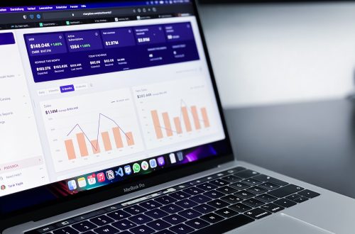
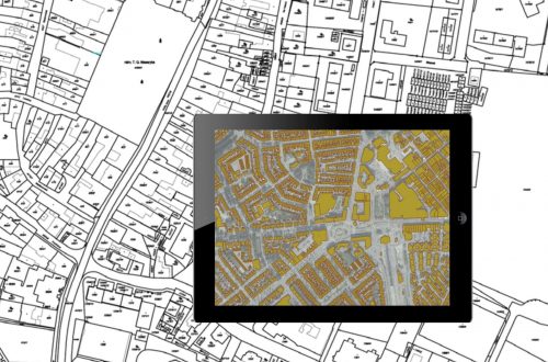
A Land Information Management System (LIMS) is a GIS-based digital platform used to manage land-related data, such as ownership, use, value, and location. It is an integrated system that enables the efficient collection, storage, retrieval, analysis, and dissemination of land information. A typical LIMS system includes various modules such as land registration, land valuation, land use planning, and land dispute resolution. These modules are designed to provide a range of functionalities, including data capture and management, data analysis, and reporting.
Benefits of LIMS:
LIMS offers several benefits that can transform land management. It can improve land governance by providing accurate, reliable, and up-to-date land-related information. LIMS can promote equitable access to land resources by enabling better planning and ensuring that land is used in a sustainable and fair manner. It can protect the rights of landowners by ensuring that their ownership is recorded correctly and that they have legal recognition of their land tenure. LIMS can also reduce corruption by providing transparency in land transactions and reducing opportunities for fraud and bribery.

Challenges of LIMS:
Despite its many benefits, implementing LIMS can be challenging. Some of the significant challenges include ensuring data quality, data privacy and security, and ensuring institutional arrangements are in place to manage the system effectively.
Real-world Examples:
Several countries have successfully implemented LIMS and have seen significant benefits. For example, India implemented a Digital India Land Record Modernization Programme previously known as the National Land Record Modernization Programme (NLRMP), which was launched in 2008 by the Government of India with the purpose to digitize and modernize land records and develop a centralized land record management system that has transformed land management in India. The system has increased transparency, improved land tenure security, and reduced land disputes. Similarly, Kenya has implemented a digital land information management system that has improved the efficiency of land transactions and reduced corruption.
Recommendations:
To successfully implement LIMS, policymakers must ensure stakeholder engagement and capacity building. They also need to provide a supportive legal and regulatory environment and ensure that the necessary institutional arrangements are in place to manage the system effectively.
Conclusion:
LIMS has the potential to revolutionize land management by bringing transparency, efficiency, and equity to the system. Despite its challenges, LIMS offers significant benefits that can transform land management and ensure the sustainable and equitable use of land resources. By embracing LIMS, countries can promote the responsible and sustainable use of land resources for generations to come.


Currently heading the Business Development at CyberSWIFT, Dip is a Creative, Collaborative, Solution-Oriented Technologist, who is passionate about providing a Win/ Win situation to both Client and Company. With 10+ years of experience in the IT & Geospatial Industry, he has been in different shoes at different times viz. Strategic Business Development, Direct Sales, Project Management, Solution Architect, etc.
Dip Mitra
Currently heading the Business Development at CyberSWIFT, Dip is a Creative, Collaborative, Solution-Oriented Technologist, who is passionate about providing a Win/ Win situation to both Client and Company. With 10+ years of experience in the IT & Geospatial Industry, he has been in different shoes at different times viz. Strategic Business Development, Direct Sales, Project Management, Solution Architect, etc.


One Comment
Gralion Torile
You are my intake, I own few blogs and very sporadically run out from to brand : (.