Uncategorised
-
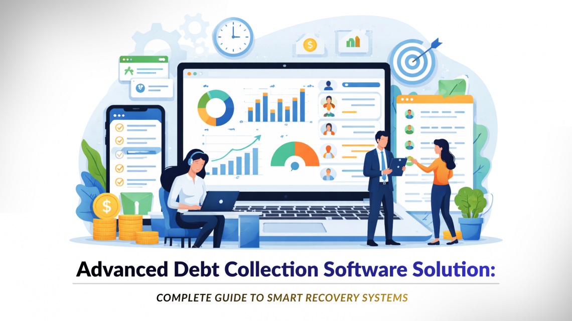
Advanced Debt Collection Software Solution: Complete Guide to Smart Recovery Systems
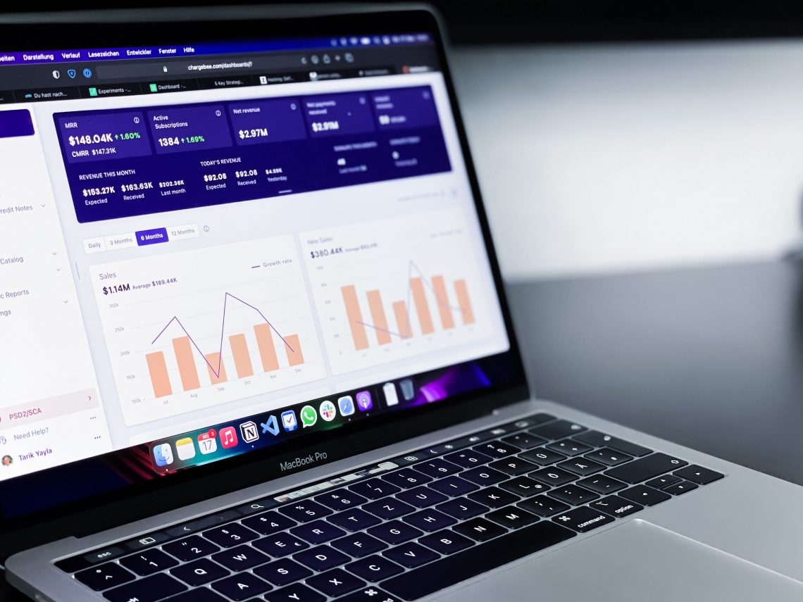
In today’s fast-evolving financial ecosystem, businesses can no longer rely on traditional methods for recovering dues. Manual follow-ups, fragmented data, and inefficient tracking often lead to delayed collections and revenue loss. An advanced debt collection software solution helps organizations automate, optimize, and scale their recovery processes efficiently. At CyberSWIFT, businesses get access to an advanced debt collection system designed to improve recovery rates while enhancing customer experience. What is an Debt Collection System? Our debt collection system is a smart platform that uses automation and analytics to manage the entire recovery lifecycle. Key Capabilities: Predictive payment behavior analysis Automated reminders and follow-ups Intelligent case prioritization Reduced manual workload This makes it an ideal end-to-end…
-
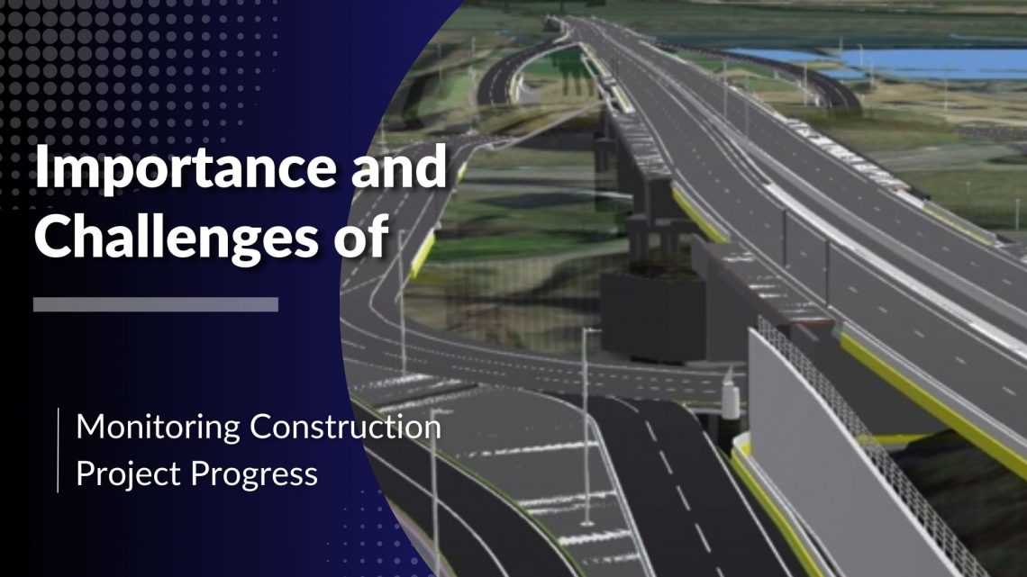
Importance and Challenges of Monitoring Construction Project Progress
The construction industry is known for its complex projects that involve multiple stakeholders, strict deadlines, and substantial financial investments. Ensuring the timely and efficient completion of these projects requires meticulous monitoring of work progress. A web-based project monitoring system plays a crucial role in streamlining this process by offering real-time insights, reducing errors, and enhancing communication among teams. However, despite the technological advancements, project managers still face several challenges in monitoring construction progress effectively. Importance of Monitoring Construction Project Progress 1. Ensuring Timely Completion Construction projects typically operate on tight schedules. Monitoring progress helps project managers ensure that tasks are completed as planned, reducing the risk of delays. By leveraging a…
-
Revolutionising Road Construction with Technology: Enhancing Project Management for a Smarter Future
The road construction industry plays a vital role in shaping modern infrastructure, driving economic growth, and ensuring efficient transportation networks. However, it faces persistent challenges, including project delays, safety risks, cost overruns, and inefficient resource management. As construction projects grow in complexity, the need for innovative solutions to boost productivity and efficiency has never been more critical. This blog delves into how technology, particularly road construction management software, is transforming the industry. By streamlining operations, improving collaboration, and addressing core project management challenges, these tools are revolutionising how roads are built. Key Challenges in Road Construction Management Road construction projects face a range of obstacles that impact timelines, budgets, and…
-
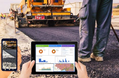
Enhancing Construction Project Management with Advanced Project Tracking Software
In the dynamic world of construction, project management plays a critical role in ensuring the timely and cost-effective completion of projects. Keeping track of multiple tasks, resources, budgets, timelines, and teams can be challenging without the right tools. This is where construction project tracking software comes into play. The Project Progress Monitoring System (PPMS) has emerged as a game-changer in construction project management, helping firms streamline their processes and achieve better efficiency. What is Construction Project Tracking Software? Construction project tracking software is a comprehensive digital solution designed to assist project managers and stakeholders in monitoring every aspect of a construction project. This software provides real-time insights into project progress,…
-
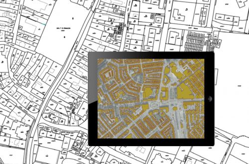
How Does a GIS-based Project Monitoring System Help in Road Construction Management?
A GIS (Geographic Information System) based project monitoring software can significantly enhance road construction monitoring management by leveraging geospatial data and analysis. Here are some ways in which GIS-based software helps in road construction management: Site Selection and Planning: GIS allows project managers to analyze various geographical factors such as terrain, soil types, land use, and environmental considerations. This aids in selecting suitable road construction sites and optimizing the project’s route and alignment. Data Integration: GIS-based software can integrate various data sources, including satellite imagery, drone surveys, LiDAR data, and ground-level data, into a single platform. This comprehensive dataset provides a holistic view of the project area and assists in…
-
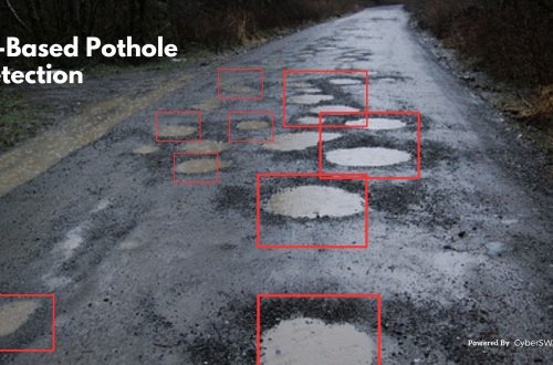
AI-Based Pothole Detection for Enhanced Road Safety
Potholes are a major safety hazard on roads. They can cause damage to vehicles, lead to accidents, and even injure or kill people. Traditional methods of pothole detection, such as manual inspection and visual surveys, are time-consuming and labor-intensive. They can also be inaccurate, especially in large or remote areas. AI-based pothole detection is a promising new technology that can help to improve road safety. These systems use cameras, sensors, and machine learning algorithms to automatically detect and identify potholes. It can be deployed in a variety of ways, including: Fixed Cameras: Fixed cameras can be installed at strategic locations along roads to monitor for potholes. These cameras can send alerts…
-
Top 10 Benefits of a GIS-Based Project Monitoring System
What is a Project Monitoring System? A GIS-based project monitoring system uses geographic information systems (GIS) technology to track and manage the progress of a project. This type of system allows users to view and analyze project data in a geographic context, such as mapping project locations and displaying information about project milestones and timelines. It also allows users to share the data with other stakeholders in a project, such as project managers, engineers, and government officials. This system can be used for a wide range of projects, including infrastructure development, natural resource management, and urban planning. Benefits of Using a Project Monitoring System: 1. Spatial Visualization: GIS-based project monitoring systems allow…
-
Case Study of Samiksha – an ambitious e-Governance initiative of PWD West Bengal
‘SAMIKSHA’ Project Progress Monitoring System is an ambitious e-Governance initiative of PWD West Bengal where a web and mobile-based software application was built to monitor the progress of various construction & maintenance projects for Roads, Bridges, and Buildings throughout the state. The initial application was implemented in June 2016 which helped 5000+ users of the department with consistent project monitoring and successful completion of more than 6000+ projects in the past 3 years.For transforming the monitoring and management system of the Public Works Department, ‘Samiksha’ PPMS succeeded in bringing about digitally enabled, real-time and interactive modes of tracking projects. This led to a sea change in the performance of the…