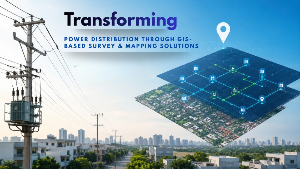
Transforming Power Distribution Through GIS-Based Survey & Mapping Solutions
In today’s rapidly evolving energy landscape, Power Distribution Companies (Discoms) face mounting challenges: aging infrastructure, increasing demand, revenue losses from unbilled consumers, frequent outages, and the need for efficient asset management.
This is where Geographic Information System (GIS)-based Survey, Mapping, and Utility Planning & Management System (UPMS) solutions are becoming game changers for utilities and DISCOMs across India.
By integrating survey data, satellite imagery, utility assets, network connectivity, consumer information, workforce activities, and SCADA systems into a centralized GIS platform, utilities can achieve real-time visibility, smarter decision-making, and efficient network management.
Why GIS is Essential for Modern Power Utilities
Power distribution networks are highly complex and continuously expanding. Utilities manage thousands of kilometers of HT/LT lines, transformers, substations, feeders, poles, underground cables, and consumer connections spread across urban and rural regions. Modern GIS survey and mapping delivers:
- Precise Asset Inventory: Every pole, transformer, substation, and line is geo-tagged with rich attribute data.
- Network Connectivity Insights: Understand how the distribution network is truly connected, from high-tension lines to end consumers.
- Data-Driven Planning: Simulate load flows, identify expansion needs, and estimate projects accurately.
- AT&C Loss Reduction: Detect illegal connections, map consumers accurately, and minimize technical & commercial losses.
- Faster Response & Maintenance: Trace faults, manage workforce, and integrate with SCADA/ERP for real-time operations.
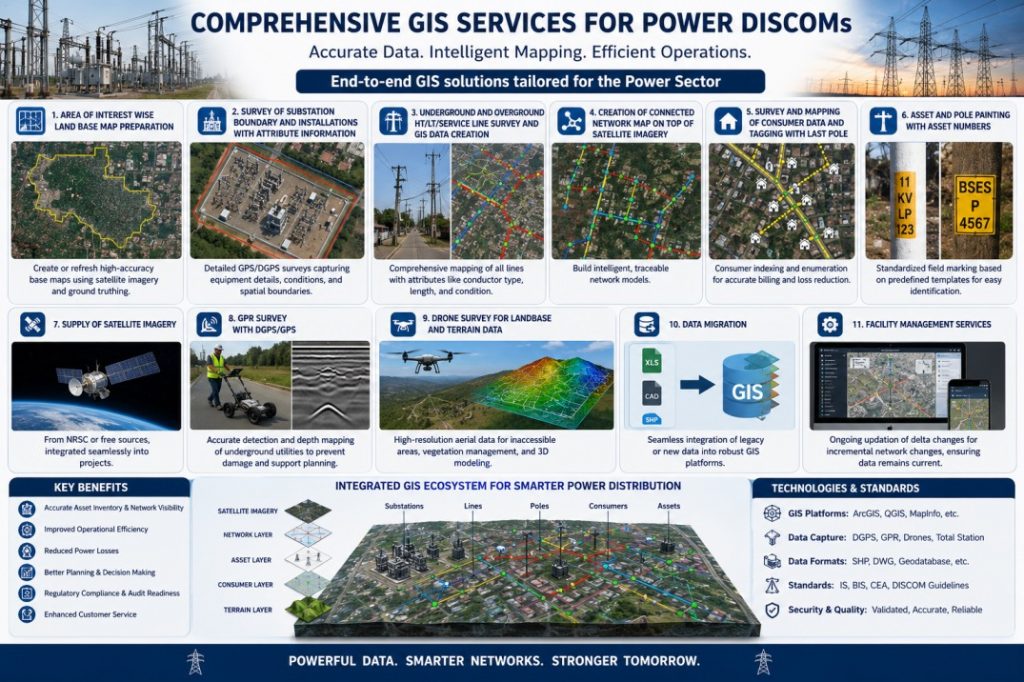
Comprehensive GIS Services for Power DISCOMs
Modern GIS solutions for power utilities include detailed surveys, mapping, asset digitization, network modeling, and enterprise integration. We offer end-to-end solutions tailored to the power sector:
- Area of Interest Wise Land Base Map Preparation: Create or refresh high-accuracy base maps using satellite imagery and ground truthing.
- Survey of Substation Boundary and Installations with Attribute Information: Detailed GPS/DGPS surveys capturing equipment details, conditions, and spatial boundaries.
- Underground and Overground HT/LT/Service Line Survey and GIS Data Creation: Comprehensive mapping of all lines with attributes like conductor type, length, and condition.
- Creation of Connected Network Map on Top of Satellite Imagery: Build intelligent, traceable network models.
- Survey and Mapping of Consumer Data and Tagging with Last Pole: Consumer indexing and enumeration for accurate billing and loss reduction.
- Asset and Pole Painting with Asset Numbers: Standardized field marking based on predefined templates for easy identification.
- Supply of Satellite Imagery: From NRSC or free sources, integrated seamlessly into projects.
- GPR Survey with DGPS/GPS: Accurate detection and depth mapping of underground utilities to prevent damage and support planning.
- Drone Survey for Land Base and Terrain Data: High-resolution aerial data for inaccessible areas, vegetation management, and 3D modeling.
- Data Migration: Seamless integration of legacy or new data into robust GIS platforms.
- Facility Management Services: Ongoing updation of delta changes for incremental network changes, ensuring data remains current.
UPMS – Utility Planning & Management System
A modern Utility Planning & Management System (UPMS) acts as a centralized platform for utility companies to create, manage, analyze, and monitor GIS data across the complete lifecycle — from planning and execution to operation and maintenance (O&M).
UPMS combines GIS web portal, mobile applications, analytics, workforce management, and SCADA integration into a unified digital ecosystem for power utilities.
Benefits of GIS & UPMS Implementation
Utilities implementing GIS and UPMS solutions gain several operational and financial benefits.
Improved Asset Visibility: Centralized mapping of all network assets.
Faster Fault Detection: Quick identification and isolation of faults.
Reduced AT&C Losses: Improved feeder and consumer analysis.
Better Planning & Expansion: Accurate GIS data supports infrastructure growth.
Enhanced Consumer Service: Faster outage response and service delivery.
Efficient Workforce Management: Digital task allocation and monitoring.
Real-Time Monitoring: Integrated SCADA and GIS visibility.
Improved Decision Making: Data-driven planning and operational intelligence.
Conclusion
At CyberSWIFT, we help power utilities and DISCOMs build intelligent, data-driven utility ecosystems through advanced GIS, mobility, analytics, SCADA integration, and enterprise utility management solutions. Our expertise spans across HT/LT network surveys, consumer indexing, underground utility mapping, drone survey, asset digitization, workforce management, and real-time GIS-enabled operational monitoring.
Whether it is modernizing legacy electrical networks, implementing GIS-enabled utility platforms, or deploying integrated UPMS solutions, CyberSWIFT delivers end-to-end capabilities that support utilities throughout the complete lifecycle — from planning and execution to operations and maintenance.

Having experience in the Geospatial Industry for more than a decade, deep domain knowledge of the GIS industry & extensive networking capacity, he is managing Power, Water & CGD Accounts Geospatial business with Government, PSU & Corporates. As an SBU manager at CyberSWIFT, Malay works closely with the Utility department Pan India with department leaders, and end-users to tailor GIS technology & GeoSpatial Solutions. He holds a GIS degree from Jadavpur University, Kolkata.
Malay Biswas
Having experience in the Geospatial Industry for more than a decade, deep domain knowledge of the GIS industry & extensive networking capacity, he is managing Power, Water & CGD Accounts Geospatial business with Government, PSU & Corporates. As an SBU manager at CyberSWIFT, Malay works closely with the Utility department Pan India with department leaders, and end-users to tailor GIS technology & GeoSpatial Solutions. He holds a GIS degree from Jadavpur University, Kolkata.

