-
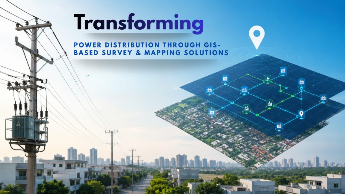
Transforming Power Distribution Through GIS-Based Survey & Mapping Solutions
In today’s rapidly evolving energy landscape, Power Distribution Companies (Discoms) face mounting challenges: aging infrastructure, increasing demand, revenue losses from unbilled consumers, frequent outages, and the need for efficient asset management. This is where Geographic Information System (GIS)-based Survey, Mapping, and Utility Planning & Management System (UPMS) solutions are becoming game changers for utilities and DISCOMs across India. By integrating survey data, satellite imagery, utility assets, network connectivity, consumer information, workforce activities, and SCADA systems into a centralized GIS platform, utilities can achieve real-time visibility, smarter decision-making, and efficient network management. Why GIS is Essential for Modern Power Utilities Power distribution networks are highly complex and continuously expanding. Utilities manage…
-
Addressing Challenges in Oil and Natural Gas Industry with GIS-Based Solutions
The oil and natural gas industry is the backbone of the global economy, providing energy for industrial operations, transportation, and household needs. However, this industry faces numerous challenges, ranging from resource exploration to environmental impact management. Geographic Information Systems (GIS) have emerged as a transformative technology to address these challenges. By integrating spatial data with advanced analytics, GIS empowers stakeholders to make informed decisions, enhance efficiency, and mitigate risks. In this blog, we will explore how GIS-based solutions are addressing some of the most pressing issues in the oil and gas sector. Common Challenges in the Oil and Gas Sector The oil and gas industry operates in a complex environment…
-
GIS-Based Solutions for Efficient Telecom Network Management
The telecom industry is undergoing rapid transformation, driven by the increasing demand for seamless connectivity, efficient network management, and improved customer experience. As networks become more complex, the need for innovative solutions to manage these networks has never been greater. Geographic Information System (GIS)-based solutions have emerged as a game-changer in the telecom sector, offering a robust platform for managing, analyzing, and visualizing network data. This blog explores how GIS-based solutions can revolutionize telecom network management, ensuring efficiency and reliability. The Importance of Efficient Telecom Network Management Efficient network management is crucial for telecom companies to meet the growing demand for high-speed internet, mobile connectivity, and other services. It involves:…
-
The Power of GIS in Urban Planning: A Comprehensive Overview
Urban planning is a dynamic and complex process that involves designing, organizing, and managing the physical, social, and economic aspects of cities. In the modern age, Geographic Information Systems (GIS) have emerged as a critical tool for urban planners, helping visualize, analyze, and manage city data efficiently. GIS allows city administrators to make data-driven decisions that shape sustainable, resilient, and smart urban environments. This blog explores how GIS technology is transforming urban planning by providing better data integration, infrastructure management, environmental analysis, and more. The Role of GIS in Urban Planning 1. Data Integration and Visualization GIS integrates various datasets, such as population demographics, land use maps, utility networks, and…
-
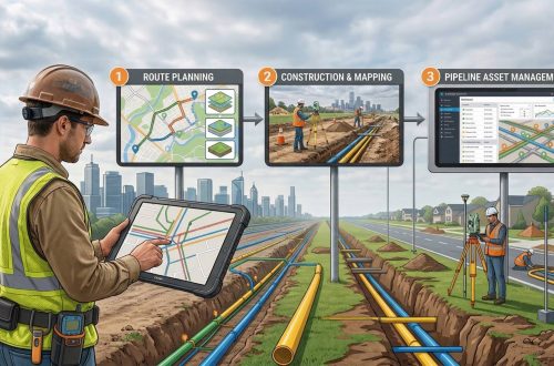
Enhancing Gas Pipeline Management with GIS: Key Benefits and Applications
In the energy and utilities sector, gas pipeline management is complex, requiring precision, safety, and a clear strategy for both existing infrastructure and future expansion. Geographic Information Systems (GIS) have revolutionized pipeline management by providing a spatially accurate, data-rich view of assets. From asset management and leak detection to route planning and demand forecasting, GIS is becoming indispensable for gas companies. This blog delves into the ways GIS transforms gas pipeline management, delivering benefits across safety, efficiency, cost-saving, and planning. 1. Asset Management and Tracking Asset management is a cornerstone of efficient gas pipeline operations. With GIS, pipeline operators can accurately locate and track each component of the pipeline infrastructure,…
-
Utility of GIS for Line Patrolling in Transmission Sector
Balancing the need to foster new markets, improve system reliability, and reduce operating costs is the greatest challenge for today’s utility departments and decision-makers—a challenge that is successfully met with CyberSWIFT’s geographic information system (GIS) and Management Information System(MIS) based web application. GIS gives solutions across the entire department for applications in business, engineering, environmental management, and other disciplines necessary for comprehensive and effective power generation, transmission management, EHV Line patrolling activity. The transmission department provides the pathway for power within the whole of a state. Department owns, builds, maintains, and operates the high-voltage electric transmission system. For maintaining such a huge transmission system one of the main activities in maintaining…
You May Also Like

Transmission Survey in Dense Forest
CyberSWIFT
Solutions With Innovative Future Technology