Addressing Challenges in Oil and Natural Gas Industry with GIS-Based Solutions
The oil and natural gas industry is the backbone of the global economy, providing energy for industrial operations, transportation, and household needs. However, this industry faces numerous challenges, ranging from resource exploration to environmental impact management. Geographic Information Systems (GIS) have emerged as a transformative technology to address these challenges. By integrating spatial data with advanced analytics, GIS empowers stakeholders to make informed decisions, enhance efficiency, and mitigate risks. In this blog, we will explore how GIS-based solutions are addressing some of the most pressing issues in the oil and gas sector.
Common Challenges in the Oil and Gas Sector
The oil and gas industry operates in a complex environment with multifaceted challenges. Some of the most critical issues include:
Exploration and Resource Mapping: Identifying viable locations for drilling and extraction is a costly and time-intensive process. Companies often face difficulties in accurately mapping underground reserves.
Pipeline Management: Managing extensive pipeline networks for the transportation of oil and gas poses logistical and maintenance challenges. Aging infrastructure, corrosion, and external damage increase the risk of leaks and failures.
Safety Concerns: Worker safety during exploration, drilling, and transportation is a major priority. Accidents such as oil spills or gas leaks can have devastating consequences.
Environmental Impact: The industry’s operations have significant environmental repercussions, including habitat destruction, water contamination, and greenhouse gas emissions. Regulatory compliance and sustainability are growing concerns for companies.
How GIS Technology Helps in Exploration and Resource Mapping
GIS is revolutionizing the way oil and gas companies approach exploration and resource mapping. By combining geospatial data with advanced modeling, GIS enables:
Enhanced Site Selection: GIS allows companies to analyze geological, topographical, and seismic data to identify the most promising locations for exploration. This reduces the time and cost associated with manual surveying.
3D Visualization: With GIS, companies can create three-dimensional models of subsurface geology, offering a clearer understanding of resource distribution.
Remote Sensing Integration: GIS integrates data from remote sensing technologies such as satellite imagery and LiDAR to provide accurate and up-to-date information on potential reserves.
Risk Assessment: GIS tools can predict geological risks, such as fault lines or unstable formations, ensuring safer drilling operations.
Pipeline Monitoring and Leak Detection Using GIS
Pipeline networks are the lifelines of the oil and gas industry, but their management comes with significant challenges. GIS-based solutions provide:
Real-Time Monitoring: By integrating GIS with IoT sensors, companies can monitor pipeline conditions in real time. This includes pressure, temperature, and flow rate.
Leak Detection: GIS tools can identify anomalies in pipeline data that may indicate leaks. By mapping these anomalies, companies can quickly locate and address issues.
Predictive Maintenance: GIS-enabled predictive analytics use historical data to forecast potential failures, allowing for proactive maintenance and reducing downtime.
Emergency Response Planning: GIS facilitates the creation of detailed maps for emergency response, highlighting critical areas, nearby resources, and evacuation routes.
Environmental Impact Assessment with GIS-Based Analysis
Environmental sustainability is a pressing concern for the oil and gas industry. GIS plays a vital role in minimizing environmental impact through:
Habitat and Land Use Analysis: GIS helps companies assess how their operations will affect local ecosystems, enabling them to develop strategies to minimize habitat destruction.
Water Resource Management: GIS tools monitor water usage and potential contamination during drilling operations, ensuring compliance with environmental regulations.
Carbon Footprint Analysis: By mapping emissions from operations, GIS helps companies identify areas for improvement and implement greener practices.
Regulatory Compliance: GIS simplifies the process of meeting regulatory requirements by providing accurate, visual data for reporting purposes.
Impact Mitigation Plans: GIS enables companies to model the potential environmental impact of new projects and design mitigation plans to minimize harm.
Conclusion
The integration of GIS technology in the oil and natural gas industry is transforming how companies address challenges in exploration, pipeline management, safety, and environmental sustainability. By leveraging spatial data and advanced analytics, GIS offers innovative solutions that enhance operational efficiency, reduce risks, and promote sustainable practices. As the industry evolves, GIS will continue to play a pivotal role in ensuring a balance between energy production and environmental stewardship.
The future of oil and gas lies in embracing technologies like GIS, which provide a competitive edge while aligning with global sustainability goals. By adopting GIS-based solutions, companies can not only overcome current challenges but also pave the way for a smarter and more responsible energy sector.

Having experience in the Geospatial Industry for more than a decade, deep domain knowledge of the GIS industry & extensive networking capacity, he is managing Power, Water & CGD Accounts Geospatial business with Government, PSU & Corporates. As an SBU manager at CyberSWIFT, Malay works closely with the Utility department Pan India with department leaders, and end-users to tailor GIS technology & GeoSpatial Solutions. He holds a GIS degree from Jadavpur University, Kolkata.
Malay Biswas
Having experience in the Geospatial Industry for more than a decade, deep domain knowledge of the GIS industry & extensive networking capacity, he is managing Power, Water & CGD Accounts Geospatial business with Government, PSU & Corporates. As an SBU manager at CyberSWIFT, Malay works closely with the Utility department Pan India with department leaders, and end-users to tailor GIS technology & GeoSpatial Solutions. He holds a GIS degree from Jadavpur University, Kolkata.


You May Also Like
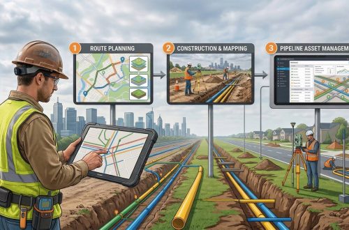
Transforming CGD Infrastructure with GIS Survey & Mapping: From Route Planning to Pipeline Asset Management