CyberSWIFT

Solutions With Innovative Future Technology

CyberSWIFT
  • LAMS,  Land

    Things to Consider Before Buying a Land Management Platform:

    5th May 2023 / 1 Comment

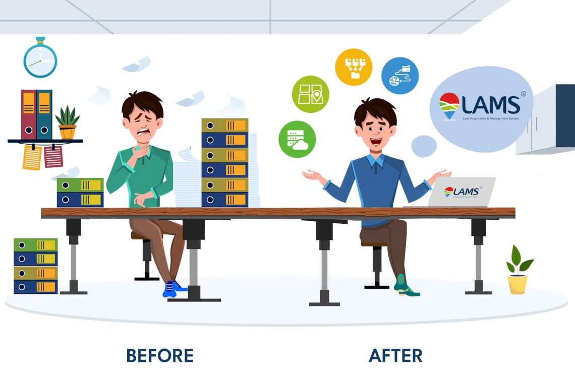
    The term “Land Asset Management System” (LAMS) refers to a software or information management system designed to streamline and manage the process of land acquisition. It is commonly used by government agencies, real estate developers, and infrastructure projects that involve acquiring land for various purposes, such as infrastructure development, urban planning, or conservation efforts. LAMS typically provides a centralized platform to track and manage the entire land acquisition lifecycle, including tasks such as land identification, negotiation, legal processes, compensation, and record keeping. Key features of a Land Acquisition Management System may include: Land Inventory: Maintaining a comprehensive inventory of available land parcels, including ownership details, boundaries, and other relevant information.…

    read more
    Dip Mitra

    You May Also Like

    the importance of land acquisition and monitoring for sustainable development

    The Importance of Land Acquisition and Monitoring for Sustainable Development

    21st October 2024

    8 Common Misconceptions about Land Management

    23rd August 2022
    smart real estate management in 2025 how gis and mis are transforming land administration

    Smart Real Estate Management in 2025: How GIS and MIS Are Transforming Land Administration

    12th February 2025

Back to site

RECENT POSTS

  • ensuring compliance when acquiring land & handling land litigation casesEnsuring Compliance When Acquiring Land & Handling Land Litigation Cases
  • a gis-based approach to road condition monitoring and pothole detection using aiA GIS-Based Approach to Road Condition Monitoring and Pothole Detection using AI
  • avoiding land disputes how to verify multiple claimants on a propertyAvoiding Land Disputes: How to Verify Multiple Claimants on a Property
  • using satellite imagery & survey data to confirm land locations how lams ensures accuracy and transparencyUsing Satellite Imagery & Survey Data to Confirm Land Locations: How LAMS Ensures Accuracy and Transparency

Categories

  • Artificial Intelligence
  • CSR
  • GIS
    • Disaster Management
  • Healthcare
  • Hoarding Management
  • LAMS
  • Land
  • Oil and Gas
  • Project Monitoring
  • RCMS
  • Remote Sensing
  • Retail
  • Salesforce
  • Telecom Utility
  • Uncategorised
    • Project Progress Monitoring System
  • Urban Development
  • Utility
  • Water Utility Solution
Copyright © 1997-2025 CyberSWIFT® Infotech Pvt. Ltd.
Ashe Theme by WP Royal.