 LAMS
LAMS
Land Acquisition & Management Software
Dedicated software that manages and consolidates all land related activities and data into a single system.

LAMS is a web and mobile based business solution that will streamline and automate the critical processes associated with land obligations and payment.
Smoothen Your Land Acquistion Activities
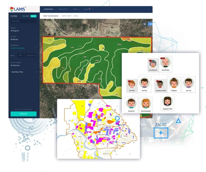
Plot Map Visualisation

Land Acquisition Process Monitoring
Owner & Family Tree Analysis
Plot & Asset Valuation
Encroachment Detection
Legal & Litigation Tracking

-
 Central storage of Land registry with recording, indexing and archiving land records and transactions for sellers, buyers, owners and lenders.
 -
 Full registry automation and historical records of ownership and encumbrance transactions for parcels.
 -
 Parcel management activities like splitting, amalgamating, and subdividing can be handled through the portal.
 -
 Fully compatible with all mobile, tablet, and desktop devices.
 -
 Property valuation tool to calculate using market value, sale price, taxable market value and tax category.
 -
 Online Permit management with Permit Requests, Request or renew business licenses and online payments.
 -
 Responsive Workflows with tasks creation, schedule, assign, track and approval.
 -
 Email and message notifications.
 -
 Customized Dashboard and Industry Standard Reports downloadable in PDF and Excel.
 Smooth implementation with Live help desk, Web support library, User training.
-
 Visualize Your Land Assets, and Land Records on an Interactive Map.
 -
 View parcel coordinates, Surface features, Waterbody, Road & Railway, Mineral assets, etc.
 -
 Integration of parcel map with ownership records through geographic indexing.
 -
 Mapping & Management of multi-locational land assets across units.
 -
 Satellite images/ Google/ Bing Map integrated on a background as background imagery.
 -
 Map tools available for Basic editing, Navigation, Drawing, Map inquiry, Geo-processing.
 -
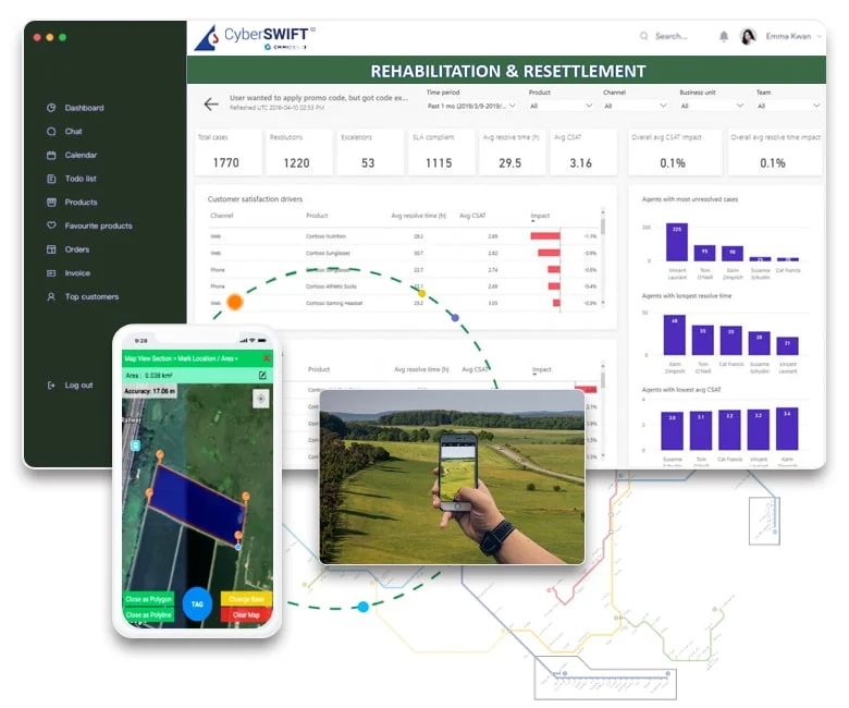
 Easy-to-use mobile app for field inspectors with inspection notifications and GIS display of site location map.
 -
 Field personnel can record inspections in the field (online & offline) with geo-tagged photographs, data, signatures etc.

Land Software Simple Pricing Section
Land Mangement Solution is entirely customisable to suit everyone’s needs. Available in mutiple versions it can adapt to your requirement.
Basics
- Login
- Landing Page
- Land Acquisition Process
- Bidding Process
- Plot Basics
- Plot Owner
- Plot Estimation
- Document Management
- Project Management
- Rehabilitated Family
- Resettlement Colony Map
- Payment Management
- Internal Resource Management
- Grievances
- Court Cases Management
- Advocate Management
- Facilitator Management
- GIS Map Display
- Map Digitisation
- Satellite Image Procurement
- Encroachment Detection
- Land Survey
- Dashboard
- Report
- Admin Features
- Mobile App [Android & iOS]
Standard
- Login
- Landing Page
- Land Acquisition Process
- Bidding Process
- Plot Basics
- Plot Owner
- Plot Estimation
- Document Management
- Project Management
- Rehabilitated Family
- Resettlement Colony Map
- Payment Management
- Internal Resource Management
- Grievances
- Court Cases Management
- Advocate Management
- Facilitator Management
- GIS Map Display
- Map Digitisation
- Satellite Image Procurement
- Encroachment Detection
- Land Survey
- Dashboard
- Report
- Admin Features
- Mobile App [Android]
Advanced
- Login
- Landing Page
- Land Acquisition Process
- Bidding Process
- Plot Basics
- Plot Owner
- Plot Estimation
- Document Management
- Project Management
- Rehabilitated Family
- Resettlement Colony Map
- Payment Management
- Internal Resource Management
- Grievances
- Court Cases Management
- Advocate Management
- Facilitator Management
- GIS Map Display
- Map Digitisation
- Satellite Image Procurement
- Encroachment Detection
- Land Survey
- Dashboard
- Report
- Admin Features
- Mobile App [Android & iOS]
Testimonials
CyberSWIFT has developed a customized web-based GIS application with mobile application and the web application is integrated with SAP.
CyberSWIFT has successfully developed the web-based GIS application on Land Management System - including customization of Map Making & Sattelite image purchasing, within the stipulated time period and the work has been found satisfactory.
CyberSWIFT has satisfactorily executed the Land Management System Software work awarded to them and no adverse report is received against the agency till date.
The assignment was successfully completed CyberSWIFT Infotech Pvt Ltd, the assignment was completed in time & work quality was satisfactory. We wish all success to them.
Download Our Brochure
Have Other Questions?
We would love to hear about your CSR initiative & would also like to help design the module & share insights about how we can possibly help you using TechCSR. We would also be happy to show you some of the ways we’ve helped customers to get where they wanted to go.
Request A Call BackOur Clients
Let’s Have a Conversation
Have a project requirement? Let us identify all your requirements and turn them into a promising solution that fits your business requirement.


