CyberSWIFT

Solutions With Innovative Future Technology

CyberSWIFT
  • using satellite imagery & survey data to confirm land locations how lams ensures accuracy and transparency
    Land

    Using Satellite Imagery & Survey Data to Confirm Land Locations: How LAMS Ensures Accuracy and Transparency

    15th May 2025 / 0 Comments

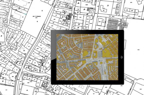
    In the age of digital transformation, managing land assets with precision has become a necessity for government bodies, infrastructure developers, and enterprises alike. With challenges like land disputes, overlapping claims, outdated land records, and encroachments plaguing traditional land management, the integration of satellite imagery and survey data offers a revolutionary approach. CyberSWIFT’s Land Management System (LAMS) leverages the power of satellite technology and on-ground surveys to validate, map, and manage land locations with unmatched accuracy. Why Accurate Land Location Matters Accurate land location data is foundational to: Resolving ownership disputes Preventing encroachments Accelerating land acquisition processes Ensuring compliance with government regulations Facilitating informed infrastructure planning and development Any ambiguity in land boundary definitions…

    read more
    Darshana Mukherjee

    You May Also Like

    the importance of land acquisition and monitoring for sustainable development

    The Importance of Land Acquisition and Monitoring for Sustainable Development

    21st October 2024
    how ownership transfers over time inheritance sales leases and beyond 

    How Ownership Transfers Over Time: Inheritance, Sales, Leases, and Beyond 

    28th August 2025
    georeferencing of cadastral maps and presenting on google earth engine through kml file, showing on a tab, laptop, mobile

    Land Records Management System Using GIS Technology

    29th September 2022

Back to site

RECENT POSTS

  • detecting unauthorized structures and encroachments on your land with lamsDetecting Unauthorized Structures and Encroachments on Your Land with LAMS
  • how ownership transfers over time inheritance sales leases and beyond How Ownership Transfers Over Time: Inheritance, Sales, Leases, and Beyond 
  • ensuring compliance when acquiring land & handling land litigation casesEnsuring Compliance When Acquiring Land & Handling Land Litigation Cases
  • a gis-based approach to road condition monitoring and pothole detection using aiA GIS-Based Approach to Road Condition Monitoring and Pothole Detection using AI

Categories

  • Artificial Intelligence
  • CSR
  • GIS
    • Disaster Management
  • Healthcare
  • Hoarding Management
  • LAMS
  • Land
  • Oil and Gas
  • Project Monitoring
  • RCMS
  • Remote Sensing
  • Retail
  • Salesforce
  • Telecom Utility
  • Uncategorised
    • Project Progress Monitoring System
  • Urban Development
  • Utility
  • Water Utility Solution
Copyright © 1997-2025 CyberSWIFT® Infotech Pvt. Ltd.
Ashe Theme by WP Royal.