-
A GIS-Based Approach to Road Condition Monitoring and Pothole Detection using AI
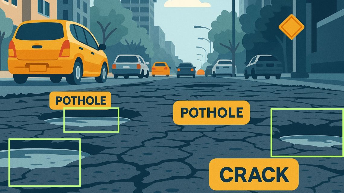
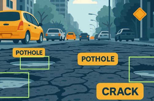
Maintaining road infrastructure is a critical responsibility for urban and rural authorities alike. Roads with potholes, cracks, and surface deterioration not only affect vehicle performance but also pose significant safety risks. A systematic and technology-enabled approach is essential for improving road conditions, optimizing road maintenance efforts, and ensuring timely project completion. This is where AI-based road condition monitoring systems come into play. They provide spatial intelligence, visual analytics, and data-driven insights that can significantly improve how road infrastructure is built and maintained. Understanding Road Condition Monitoring Systems A road condition monitoring system is a comprehensive framework that continuously assesses the health of road infrastructure. It combines with field data to…
-
Challenges in Monitoring Road Infrastructure and GIS-Based Solutions
Road infrastructure is the backbone of a country’s economy, facilitating trade, transportation, and connectivity. However, maintaining and monitoring road conditions is a complex task due to various challenges such as wear and tear, weather conditions, increasing vehicular load, and lack of real-time data. Traditional road monitoring methods often rely on manual inspections, which are time-consuming, expensive, and prone to errors. The integration of Geographic Information Systems (GIS) into road infrastructure monitoring provides a more efficient, accurate, and cost-effective solution. AI-based Road Condition Monitoring Systems leverage advanced machine learning algorithms and computer vision to detect road damages such as potholes, cracks, and surface degradation in real-time. These systems enhance efficiency by automating…
CyberSWIFT
Solutions With Innovative Future Technology