GIS
-
How GIS and Remote Sensing Are Playing the Most Critical Role in Disaster Management?
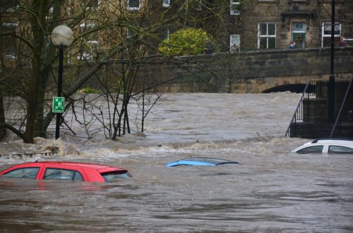
India has been ranked the 14th most disaster-prone country in the world due to extreme weather-related disasters. Also, disasters are spatial in nature as they strike at a particular location and impact a specific region. GIS & remote sensing are inevitable parts of the disaster monitoring life-cycle. The preparedness stage of the pre-disaster situation is followed by during & post-disaster which is attributed to response & recovery & rehabilitation efforts. GIS provides accurate spatial data and insights into disaster response strategies and enables the visualization of critical vulnerabilities and damages. Subsequently, location intelligence plays a critical part in disaster monitoring. GIS combined with remote sensing gives an essential structure, helps in…
-
Case Study of Samiksha – an ambitious e-Governance initiative of PWD West Bengal
‘SAMIKSHA’ Project Progress Monitoring System is an ambitious e-Governance initiative of PWD West Bengal where a web and mobile-based software application was built to monitor the progress of various construction & maintenance projects for Roads, Bridges, and Buildings throughout the state. The initial application was implemented in June 2016 which helped 5000+ users of the department with consistent project monitoring and successful completion of more than 6000+ projects in the past 3 years.For transforming the monitoring and management system of the Public Works Department, ‘Samiksha’ PPMS succeeded in bringing about digitally enabled, real-time and interactive modes of tracking projects. This led to a sea change in the performance of the…
-
Five Benefits of GIS for Healthcare Providers
Are you using the power of geoinformation in your medical practice or healthcare services business? Geography matters, especially in the modern hyper-connected world where the rise of consumer information sharing can make or break a service practitioner’s reputation in a market. Meanwhile patients increasingly expect convenience, value and efficiency when using their time. They are savvier than ever before about shopping and competition for their attention and shopping dollars is fierce. Don’t worry, we have a prescription that can help, it’s called GIS! Geographical Information Systems (GIS) and location intelligence data software can produce highly visual, highly useful data driven maps of a region, city, neighborhood, market or even inside…
-
Five Critical Benefits of Location Intelligence for Retailers
Are you using the power of geoinformation in your business? Geography matters, especially in the modern hyper-connected world where the rise of ecommerce means physical stores must not only offer desirable products of value for a fair price, but must also provide high levels of customer service, and somehow continuously be crafting a bigger and better in-store experience for their customers than their competitors. Meanwhile customers increasingly expect convenience, value and efficiency when using their time to visit physical stores instead of shopping online. They are savvier than ever before about shopping and competition for their attention and shopping dollars is fierce. Good news! There is a tool set you…