CyberSWIFT

Solutions With Innovative Future Technology

CyberSWIFT
  • GIS-based Project Monitoring System Help in Road Construction Management
    GIS,  Project Progress Monitoring System,  Urban Development

    How Does a GIS-based Project Monitoring System Help in Road Construction Management?

    7th August 2023 / 0 Comments

    A GIS (Geographic Information System) based project monitoring software can significantly enhance road construction monitoring management by leveraging geospatial data and analysis. Here are some ways in which GIS-based software helps in road construction management: Site Selection and Planning: GIS allows project managers to analyze various geographical factors such as terrain, soil types, land use, and environmental considerations. This aids in selecting suitable road construction sites and optimizing the project’s route and alignment. Data Integration: GIS-based software can integrate various data sources, including satellite imagery, drone surveys, LiDAR data, and ground-level data, into a single platform. This comprehensive dataset provides a holistic view of the project area and assists in…

    read more
    Dip Mitra

    You May Also Like

    land litigation software

    Discover The Importance of Land Software in Land-Related Litigation Cases

    23rd June 2023
    agriculture land with map pin to define the land area

    Revolutionizing Land Management with Land Information Management Systems

    30th March 2023

    Top 10 Benefits of a GIS-Based Project Monitoring System

    27th January 2023

Back to site

RECENT POSTS

  • ensuring compliance when acquiring land & handling land litigation casesEnsuring Compliance When Acquiring Land & Handling Land Litigation Cases
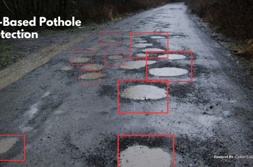
  • a gis-based approach to road condition monitoring and pothole detection using aiA GIS-Based Approach to Road Condition Monitoring and Pothole Detection using AI
  • avoiding land disputes how to verify multiple claimants on a propertyAvoiding Land Disputes: How to Verify Multiple Claimants on a Property
  • using satellite imagery & survey data to confirm land locations how lams ensures accuracy and transparencyUsing Satellite Imagery & Survey Data to Confirm Land Locations: How LAMS Ensures Accuracy and Transparency

Categories

  • Artificial Intelligence
  • CSR
  • GIS
    • Disaster Management
  • Healthcare
  • Hoarding Management
  • LAMS
  • Land
  • Oil and Gas
  • Project Monitoring
  • RCMS
  • Remote Sensing
  • Retail
  • Salesforce
  • Telecom Utility
  • Uncategorised
    • Project Progress Monitoring System
  • Urban Development
  • Utility
  • Water Utility Solution
Copyright © 1997-2025 CyberSWIFT® Infotech Pvt. Ltd.
Ashe Theme by WP Royal.