GIS-Based Project Progress Monitoring System for Construction & Government Infrastructure Projects
Large-scale infrastructure development—such as highways, railways, irrigation systems, utilities, mining corridors, and smart cities—requires continuous, data-driven oversight across geographically distributed assets.
Traditional project management systems rely heavily on:
- Manual reporting cycles
- Dynamic MIS dashboards
- Spreadsheet-based tracking
- Periodic site inspections
These approaches are insufficient for modern infrastructure complexity.
A GIS-based Project Progress Monitoring System (PPMS) introduces a paradigm shift by integrating:
- Geospatial Information Systems (GIS)
- Management Information Systems (MIS)
- Real-time field data capture
- Spatial analytics and visualization
- Automated reporting engines
PPMS (Project Progress Monitoring System) is built precisely on this GIS-MIS convergence model, enabling real-time, location-aware project governance across the entire lifecycle—from planning to execution and closure.
Architecture of a GIS-Based Project Progress Monitoring System
A robust PPMS architecture is typically composed of the following layers:
Data Acquisition Layer (Field + Remote Sensing)
- Mobile GIS applications for field engineers
- Geo-tagged photo/video capture
- UAV/drone imagery integration
- IoT sensor feeds (optional for smart infrastructure)
- Satellite imagery overlays
PPMS integrates field-level geotagged data capture and UAV-based monitoring for real-time validation of physical progress.
Spatial Data Management Layer (GIS Engine)
- Spatial database (PostGIS / Oracle Spatial / ArcGIS Enterprise)
- Layered mapping structure:
- Project boundaries
- Work packages
- Asset-level segmentation
- Utility corridors / alignments
- Coordinate reference system (CRS) standardization
- Topology validation and spatial indexing
This enables location-based project structuring, ensuring every activity is tied to a precise geographic entity.
MIS & Project Control Layer
- Work breakdown structure (WBS) integration
- Milestone-based progress tracking
- Resource allocation and contractor performance tracking
- Financial progress linking (cost vs physical progress correlation)
- Delay and deviation analysis engine
PPMS integrates MIS workflows with GIS to provide decision-grade project intelligence dashboards.
Analytics & Decision Support Layer
- Spatial-temporal analytics (progress over time + location)
- Earned Value Management (EVM) indicators
- Bottleneck detection algorithms
- Delay risk prediction models
- Zone-wise performance heatmaps
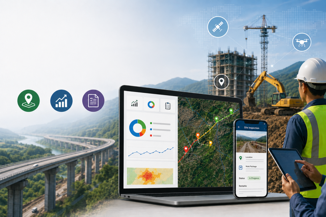
Visualization & Command Center Layer
- Web GIS dashboards
- Layer-based thematic mapping
- Live project progress maps
- Multi-project control center view
- Drill-down analytics from state → district → site → asset level
Why GIS is Critical for Project Progress Monitoring
Spatial Context for Infrastructure Execution
Infrastructure is inherently spatial:
- Roads follow alignments
- Pipelines follow corridors
- Utilities span networks
- Land acquisition is parcel-based
GIS provides the spatial backbone for structuring project execution logically and geographically.
Real-Time Project Progress Updates
GIS-enabled PPMS systems allow:
- Live field updates via mobile GIS apps
- Geo-tagged validation of work completion
- Instant synchronization with central servers
- Progress visualization on dynamic maps
This enables real-time project progress updates, eliminating reporting lag.
Spatial Deviation & Delay Detection
Using GIS overlays:
- Planned vs actual progress can be compared spatially
- Delayed zones can be highlighted in red-layer mapping
- Contractor-wise performance can be spatially benchmarked
Project Progress Measurement System (GIS + MIS Hybrid Model)
A project progress measurement system in PPMS is not purely numeric—it is spatially computed.
Key Technical Mechanisms:
- Segment-wise progress calculation (road chainage / grid cells)
- Weightage-based milestone scoring
- GIS polygon completion mapping
- Asset-level status tagging (Not Started / In Progress / Completed)
- Integration with e-Measurement Book (e-MB) systems
CyberSWIFT PPMS integrates physical + financial progress tracking using e-MB and GIS analytics, ensuring audit-ready accuracy.
Progress Monitoring Tools in PPMS Ecosystem
A modern PPMS includes a suite of enterprise-grade tools:
GIS Dashboard Engine
- Layer-based map visualization
- Time slider for progress evolution
- Heatmaps for delayed zones
Field Mobility System
- Android/iOS inspection apps
- Offline data capture capability
- Geo-fencing for site validation
UAV & Remote Sensing Module
- Drone-based site surveys
- Periodic aerial progress comparison
- Orthomosaic map generation
Document & Workflow Engine
- Contract document management
- Legal case tracking
- Approval workflows
Command & Control Center
- Centralized monitoring hub
- Multi-project visualization
- Real-time alerts and escalation system
Project Progress Reports Generation (Automated GIS Reporting Engine)
One of the most critical components of PPMS is automated reporting.
System capabilities include:
- Auto-generated daily / weekly / monthly reports
- GIS-integrated visual reporting (maps + charts + tables)
- Milestone-based progress summaries
- Financial vs physical progress correlation reports
- Contractor-wise performance reports
- Delay analysis reports with spatial tagging
CyberSWIFT PPMS provides instant report generation in PDF and Excel formats directly from GIS dashboards, reducing manual reporting effort significantly.
Why Government Bodies Need GIS-Based PPMS
For public infrastructure governance, PPMS ensures:
Transparency & Accountability
- Every project activity is geo-verified
- Audit trails for each site update
- Real-time visibility for stakeholders
Better Fund Utilization Tracking
- GIS-linked expenditure tracking
- Physical vs financial progress reconciliation
Faster Decision Making
- Bottleneck detection through spatial analytics
- Instant escalation of delayed projects
Multi-Agency Coordination
- Unified platform for contractors, consultants, and departments
Why Construction Companies Need GIS-Based PPMS
For EPC contractors and infrastructure developers:
- Improved project delivery accuracy
- Reduced cost overruns through early delay detection
- Better resource optimization across sites
- Stronger compliance and client reporting
- Competitive advantage in government tenders
Role of PPMS in Digital Infrastructure Transformation
CyberSWIFT PPMS acts as a GIS-enabled digital twin of infrastructure projects, combining:
- Spatial intelligence (GIS)
- Operational intelligence (MIS)
- Field intelligence (mobile + UAV)
- Analytical intelligence (dashboards + KPIs)
It supports end-to-end monitoring of infrastructure such as:
- Roads & highways
- Bridges & metros
- Water & irrigation systems
- Power & utility networks
- Smart city infrastructure
From Manual Monitoring to Spatial Intelligence Systems
The future of infrastructure governance lies in GIS-driven digital ecosystems, where every project is:
- Mapped
- Measured
- Monitored
- Managed
- Reported
in real time.
A GIS-based Project Progress Monitoring System like CyberSWIFT PPMS transforms traditional project management into a spatial intelligence platform, enabling governments and construction companies to achieve:
- Higher transparency
- Faster execution
- Accurate reporting
- Predictive control over delays

Experienced Consultant with a demonstrated history of working in the Information Technology and Services Industry. My role at CyberSWIFT Infotech Pvt. Ltd. is all about building Business Relationships & nurturing them with my ability & trust for growth. My Skills involve Business Communication, Business Analysis, Strategy Formulation & Planning, Understanding Customer Requirements, Providing Geospatial Solutions , Conducting DGPS Survey , Building WebGIS Applications & implementing many more GIS-based smart strategies to cater to the needs of my client.
Aman Prabhakar
Experienced Consultant with a demonstrated history of working in the Information Technology and Services Industry. My role at CyberSWIFT Infotech Pvt. Ltd. is all about building Business Relationships & nurturing them with my ability & trust for growth. My Skills involve Business Communication, Business Analysis, Strategy Formulation & Planning, Understanding Customer Requirements, Providing Geospatial Solutions , Conducting DGPS Survey , Building WebGIS Applications & implementing many more GIS-based smart strategies to cater to the needs of my client.


You May Also Like
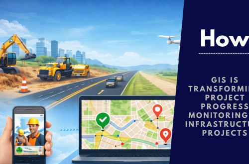
How GIS is Transforming Project Progress Monitoring in Infrastructure Projects

PPMS Software: Revolutionizing Project Management with the Project Monitoring Portal