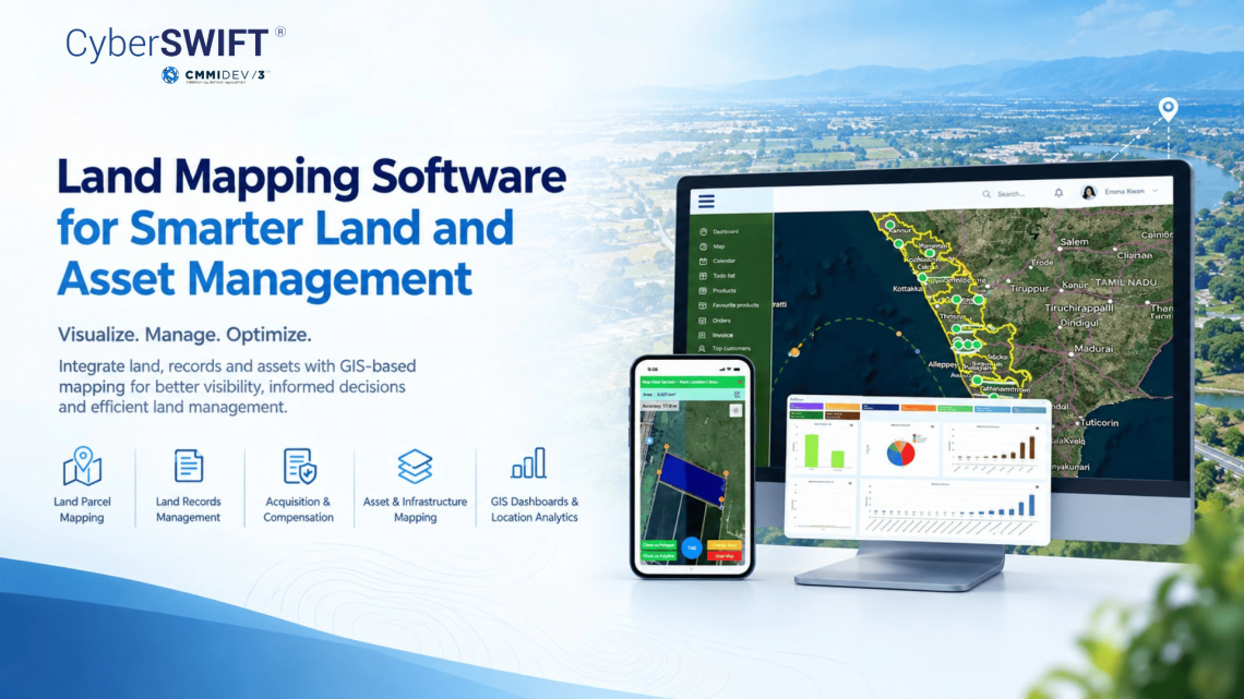
Land Mapping Software for Smarter Land and Asset Management
Managing land, property, infrastructure, and associated assets across multiple locations can be challenging for organizations with large and geographically distributed landholdings. Traditional spreadsheets, paper records, and disconnected databases often make it difficult to maintain accurate information and understand the relationship between land parcels and physical assets.
Modern land mapping software combines GIS technology with land and asset information to provide a centralized, map-based view of landholdings, properties, infrastructure, and related records. LAMS (Land Acquisition & Management System) helps organizations digitize and manage these activities through an integrated land management platform.
What Is Land Mapping Software?
Land mapping software is a GIS-enabled solution that helps organizations digitally map land parcels and connect geographic information with important land records.
Instead of maintaining land information separately from maps, organizations can associate parcel boundaries with ownership details, survey information, documents, acquisition status, valuation, legal records, and other relevant information.
The same mapping environment can also be used to locate and manage associated assets such as buildings, roads, utilities, equipment, and other infrastructure.
This creates a connected view of land, location, records, and assets within a single system.
How GIS Mapping Supports Land Management
GIS-based land mapping provides more than just a visual representation of property boundaries. It enables organizations to access and analyze location-based information for better land management.
Key capabilities can include:
- Digital land parcel and boundary mapping
- Centralized land records management
- Land acquisition and compensation tracking
- Ownership and document management
- Land valuation and land bank management
- Asset and infrastructure location mapping
- Encroachment and litigation monitoring
- Mobile-based field survey and data collection
- GIS dashboards and location-based reporting
By connecting spatial data with business information, organizations can gain better visibility into their landholdings and associated resources.
Land Mapping for Land Acquisition and Infrastructure Projects
Large infrastructure projects such as highways, railways, pipelines, transmission lines, industrial corridors, and urban development projects often involve significant land requirements.
A GIS-based land acquisition software solution can help organizations identify affected parcels, visualize project boundaries, monitor acquisition progress, and maintain related documentation.
Land mapping also helps connect project locations with RoW, structures, utilities, and other assets. Field teams can collect geotagged information and update land or asset records, helping maintain a more current digital representation of project areas.
Managing Land and Assets in One Platform
For organizations with extensive landholdings, land records and physical assets are often closely connected. A building may be located on a particular plot, a road may pass through multiple parcels, or infrastructure assets may be distributed across a project corridor.
An integrated asset mapping software approach allows these relationships to be represented geographically. Users can identify where assets are located and associate them with relevant land parcels, projects, or properties.
This can support land utilization monitoring, asset identification, field verification, infrastructure planning, and location-based reporting.
LAMS for GIS-Based Land Management
LAMS (Land Acquisition & Management System) is an integrated GIS and MIS-based land management solution designed for organizations managing large landholdings and land-intensive projects.
LAMS brings together land mapping, land records, acquisition workflows, documentation, valuation, legal information, and related asset data within a centralized platform.
Its capabilities can support:
- GIS-based land parcel visualization
- Land records and document management
- Land acquisition and compensation management
- Land bank and lease management
- Ownership and family-tree information
- Encroachment and litigation tracking
- Field survey and geotagged data collection
- Land and asset mapping
- Dashboards, reports, and location-based analytics
The platform can be customized according to organizational workflows and can support integration with enterprise systems where required.
Applications Across Industries
GIS-based land and asset mapping can support organizations across several land-intensive sectors, including lams for infrastructure industry, mining, manufacturing, real estate, renewable energy, and government.
It can help organizations maintain a centralized view of land parcels, project areas, properties, infrastructure, and associated records while improving access to location-based information.
Conclusion
Effective land management requires more than maintaining property records. Organizations need to understand where their land is located, what it contains, how it is being used, and what assets are associated with it.
Modern land mapping software and asset mapping software bring these different information layers together through GIS, helping organizations build a more connected and digitally accessible land information environment.
With its combination of GIS mapping, land records, acquisition management, field data collection, and asset information, LAMS provides a comprehensive platform for organizations looking to modernize their land management processes.

Darshana Mukherjee is a Senior Consultant in Business Development with over 11 years of experience in sales, primarily focused on the Geospatial IT industry. Her expertise lies in driving business growth through strategic partnerships, client engagement, and delivering solutions. She combines her technical knowledge with business acumen to contribute effectively to organizational success.
Darshana Mukherjee
Darshana Mukherjee is a Senior Consultant in Business Development with over 11 years of experience in sales, primarily focused on the Geospatial IT industry. Her expertise lies in driving business growth through strategic partnerships, client engagement, and delivering solutions. She combines her technical knowledge with business acumen to contribute effectively to organizational success.

You May Also Like

The Importance of Land Acquisition and Monitoring for Sustainable Development
Linking Cadastral Maps and RoR Records: The Backbone of Modern GIS-Based Land Record Management