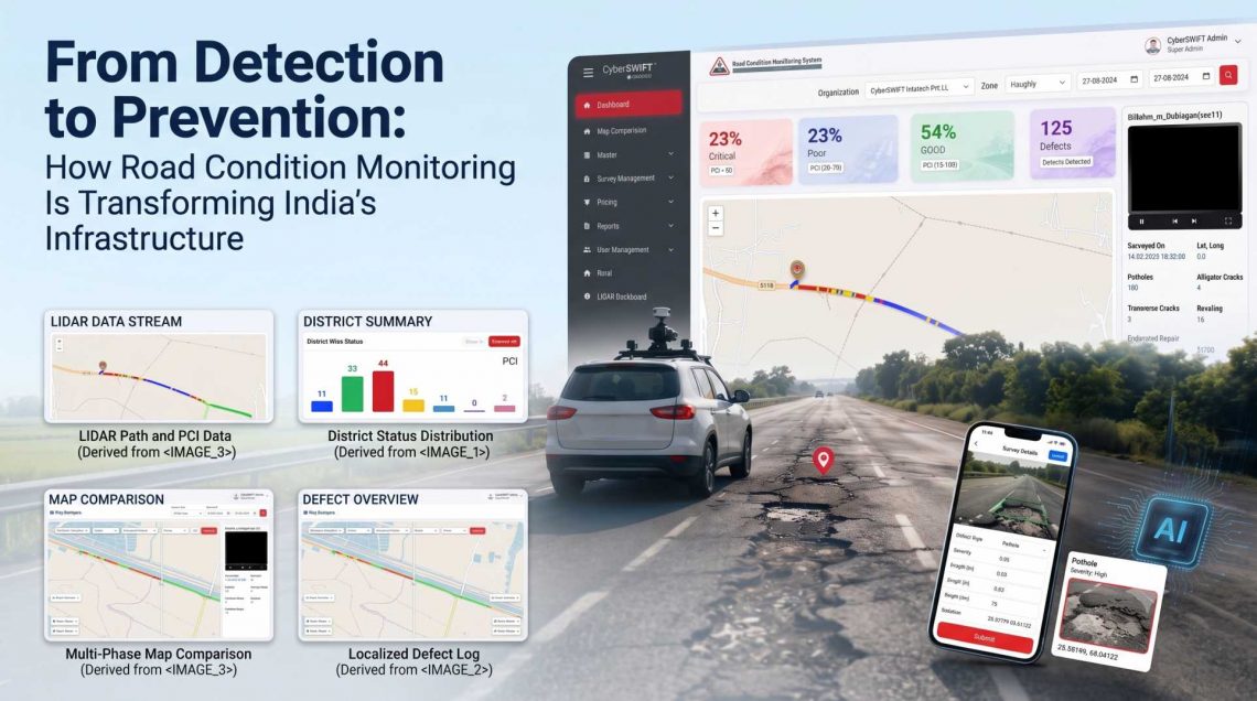
From Detection to Prevention: How Road Condition Monitoring Is Transforming India’s Infrastructure
India’s road network is the backbone of economic activity, connecting cities, industries, rural communities, markets, and essential services. However, maintaining this vast network is a continuous challenge. Heavy traffic, monsoon rainfall, extreme temperatures, drainage issues, aging pavement, and delayed maintenance can gradually turn minor defects into major infrastructure problems.
Traditional road inspections often depend on periodic manual surveys, which can be time-consuming, difficult to scale, and limited in their ability to provide continuous visibility. Today, technology is changing this approach. A modern road condition monitoring system combines Artificial Intelligence (AI), Geographic Information System (GIS), mobile-based data collection, video analytics, and interactive mapping to move road maintenance from reactive repairs toward proactive and preventive infrastructure management.
For road authorities and infrastructure managers, the shift is significant: instead of asking “Where is the damage?”, they can increasingly ask “Where is the road likely to deteriorate next, and what can we do about it?”
What Is Road Condition Monitoring?
Road condition monitoring is the systematic process of collecting, analyzing, mapping, and managing information about the physical condition of roads and related assets.
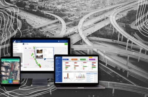
A modern road condition assessment system can capture information such as:
- Potholes and surface defects
- Cracks and pavement deterioration
- Road surface damage and distress
- Defect location and geographic coordinates
- Defect severity and dimensions
- Road segments requiring maintenance
- Before-and-after repair conditions
When this information is integrated with GIS, it becomes more than a collection of inspection records. A GIS based road condition monitoring system provides a spatial view of road conditions, allowing authorities to understand exactly where problems occur, identify high-risk stretches, compare road segments, and prioritize maintenance activities.
Why India Needs Smarter Road Monitoring
India’s road infrastructure operates under highly diverse conditions. A highway in a major metropolitan area experiences very different stresses from a rural road, mountain route, or coastal corridor.
Several factors contribute to road deterioration:
1. Heavy Traffic Loads
High traffic volumes and repeated heavy-vehicle movement accelerate pavement wear. Roads carrying freight traffic may experience deterioration much faster than lightly used roads.
2. Monsoon and Extreme Weather
Water infiltration, inadequate drainage, heavy rainfall, and temperature variations can weaken road structures and accelerate the formation of cracks and potholes.
3. Aging Infrastructure
As pavement approaches the end of its service life, maintenance requirements increase. Without timely intervention, relatively small defects can develop into expensive structural problems.
4. Large and Distributed Road Networks
Monitoring thousands of kilometres of roads through manual inspection alone is challenging. Authorities need scalable technologies that can collect and process road condition information efficiently.
These challenges make a centralized GIS road condition monitoring system increasingly valuable for evidence-based infrastructure management.
From Manual Inspection to Intelligent Road Monitoring
Traditional road inspections generally involve field teams travelling along road segments, recording defects, taking photographs, and preparing reports. While manual inspection remains valuable, relying exclusively on it can make monitoring slower and more difficult to scale.
An AI-enabled road inspection management system can supplement field surveys through mobile and camera-based data collection.
A typical workflow can include:
Data Collection → AI Processing → Defect Detection → GIS Mapping → Condition Assessment → Maintenance Prioritization → Repair → Post-Repair Verification
This creates a continuous information cycle rather than a one-time inspection exercise.
AI-Powered Road Defect Detection
One of the most important developments in modern road monitoring is automated defect identification.
A road defect detection system can process images or video collected from vehicles and identify visible road defects using AI-based image analysis.
Depending on the system and available data, this can include:
- Potholes
- Surface cracks
- Road distress
- Other visible pavement defects
The technology can significantly reduce the amount of manual effort required to review large volumes of road imagery.
Pothole Detection System
Potholes are among the most visible and disruptive forms of road deterioration. Early identification allows maintenance teams to respond before defects become larger and more hazardous.
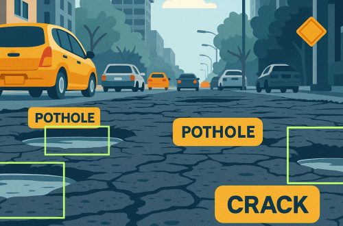
A pothole detection system can use camera-based road surveys and AI algorithms to identify potholes from captured road footage. Detected potholes can then be associated with geographic coordinates and other condition information.
Instead of simply reporting that a pothole exists, the system can help answer:
- Where is the pothole located?
- How severe is the defect?
- What road segment is affected?
- Which defects should receive priority?
- Has the defect been repaired?
- What was the condition before and after maintenance?
This transforms pothole reporting into a structured road management process.
GIS: Turning Road Data into Actionable Information
AI can identify defects, but location is equally important. This is where GIS becomes a critical component of a modern GIS based road management system.
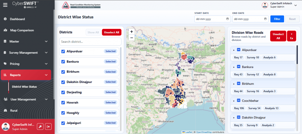
With GIS-based road condition mapping, road authorities can visualize defects directly on an interactive map.
Different map layers can represent:
- Road networks
- Pothole locations
- Defect severity
- Road condition ratings
- Inspection records
- Maintenance activities
- Repaired road segments
Users can filter and analyze information based on location, severity, road segment, or other available attributes.
This spatial approach makes complex road condition data easier to understand and supports faster decision-making.
From Road Inspection to Road Asset Management
Roads are more than pavement surfaces. They are part of a wider infrastructure ecosystem that may include bridges, culverts, drainage structures, signs, markings, and other road-related assets.
Integrating condition information into a road asset management system allows authorities to maintain a broader digital inventory of infrastructure assets.
GIS-based road asset management can help organizations understand:
- What assets exist?
- Where are they located?
- What is their current condition?
- Which assets require attention?
- What maintenance has already been performed?
- Where should resources be allocated?
This creates a more comprehensive approach to infrastructure management rather than treating each defect as an isolated maintenance request.
From Detection to Prevention
The biggest transformation in modern road monitoring is the movement from reactive to preventive maintenance.
A traditional approach may look like this:
Defect occurs → Complaint received → Inspection → Repair
A technology-enabled approach can move toward:
Continuous monitoring → Early detection → Condition analysis → Risk prioritization → Preventive maintenance
This distinction matters because early intervention can prevent minor deterioration from developing into more extensive damage.
A comprehensive road maintenance management system can help authorities prioritize maintenance based on available condition data instead of relying only on complaints or fixed inspection schedules.
Road Condition Assessment for Better Prioritization
Not every road defect requires the same response. A minor surface defect on a low-risk road segment may not require the same urgency as a severe pothole on a heavily travelled corridor.
A road condition assessment system can bring different inspection parameters together to support prioritization.
For example, maintenance teams may evaluate:
- Defect type
- Defect severity
- Geographic location
- Road importance
- Traffic exposure
- Previous inspection history
- Repair status
The result is a more structured maintenance strategy in which available budgets, manpower, and equipment can be directed toward higher-priority requirements.
Before-and-After Monitoring
Monitoring should not end when a repair is completed.
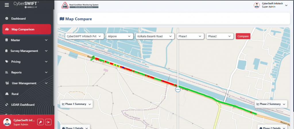
One valuable capability of an integrated road monitoring platform is the ability to compare road conditions before and after maintenance.
For example:
Before Repair → Defect Recorded → Maintenance Completed → Post-Repair Survey → Condition Compared
This creates a digital record of maintenance performance and helps authorities verify whether the intervention addressed the identified problem.
It also supports long-term historical analysis, allowing road managers to understand how individual road segments change over time.
How Road Condition Monitoring Improves Infrastructure Management
A technology-driven road infrastructure monitoring system can provide several practical benefits.
Better Road Safety
Earlier identification of potholes and road defects allows maintenance teams to address hazardous conditions more quickly, contributing to safer road environments.
Faster Inspections
Mobile and video-based data collection can cover large road stretches more efficiently than relying entirely on manual observation.
Data-Driven Decisions
GIS maps, condition information, and historical records provide a stronger basis for deciding where maintenance resources should be deployed.
Reduced Maintenance Costs
Preventive intervention can help avoid situations where minor defects develop into more extensive and expensive repairs.
Improved Transparency
Digitized inspection and maintenance records create a traceable history of road conditions and interventions.
Scalable Monitoring
A digital platform can expand as the monitored road network grows, supporting infrastructure agencies across larger geographic areas.
The Role of Mobile-Based Road Surveys
Modern road monitoring does not necessarily require complex dedicated hardware on every vehicle.
Camera-equipped vehicles and mobile applications can capture road footage while travelling along road networks. The collected data can then be uploaded for processing and analysis.
This approach can make road surveys more practical across urban, rural, and remote areas.
The resulting information can feed into GIS road inspection, where inspection results are linked with geographic locations and displayed through a centralized platform.
Building a Data-Driven Road Maintenance Ecosystem
A successful road monitoring solution is not simply an AI model or a map. It is an integrated ecosystem connecting field data, analytics, GIS, inspection workflows, and maintenance decisions.
A typical architecture may include:
Field Data Collection
Mobile devices and vehicle-mounted cameras capture road condition information.
AI-Based Analysis
AI processes images or video to identify relevant road defects.
GIS Integration
Detected defects are associated with geographic coordinates and mapped against the road network.
Condition Assessment
Road segments are evaluated using available inspection and defect information.
Dashboard and Visualization
Authorities access maps, reports, and condition insights through a centralized interface.
Maintenance Management
Maintenance teams use the information to prioritize and track interventions.
Post-Repair Monitoring
New surveys can verify completed work and update the road condition database.
This connected approach turns individual inspection activities into a continuously improving road management system.
Challenges in Implementing Road Condition Monitoring
Technology can significantly improve road monitoring, but successful implementation requires attention to several factors.
Data Quality
AI-based analysis depends on the quality and consistency of captured images, videos, geographic information, and inspection records.
Large-Scale Data Processing
Monitoring extensive road networks can generate substantial volumes of imagery and geospatial data. Efficient processing and storage are therefore essential.
Diverse Road Conditions
Indian roads vary significantly in pavement type, climate, traffic, terrain, and maintenance history. Solutions need to work across diverse environments.
Integration with Existing Systems
Organizations may already have road inventories, inspection records, GIS databases, and maintenance workflows. Integrating new technology with existing systems can improve its practical value.
Continuous Improvement
AI models and road monitoring workflows benefit from ongoing validation, refinement, and updates as new road-condition data becomes available.
The Future of Road Condition Monitoring in India
The future of road management will increasingly depend on combining AI, GIS, mobile technologies, data analytics, and digital infrastructure records.
The evolution can be viewed in three stages:
Detection: Identify potholes, cracks, and other road defects.
Assessment: Understand their location, severity, frequency, and impact.
Prevention: Use historical and current information to prioritize interventions before deterioration becomes more serious.
This progression can transform road management from a reactive maintenance function into a proactive infrastructure strategy.
As more road data becomes available, organizations can build richer historical datasets, identify recurring problem areas, monitor deterioration patterns, and improve long-term maintenance planning.
How CyberSWIFT Is Supporting Smarter Road Infrastructure
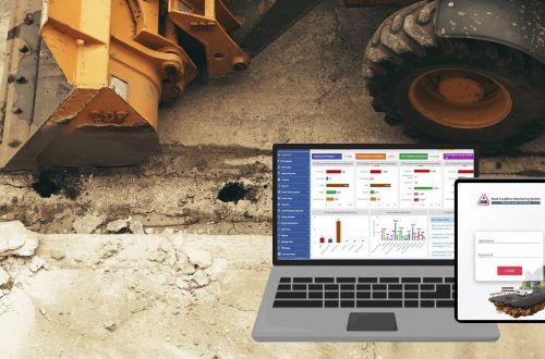
For organizations responsible for managing extensive road networks, a modern road condition monitoring software can provide a centralized platform for collecting, analyzing, mapping, and managing road condition information.
CyberSWIFT Infotech Private Limited’s Road Condition Monitoring System (RCMS) brings together AI-powered data processing, mobile-based data collection, GIS visualization, and road condition analysis to support smarter road monitoring and maintenance.
The platform can help transform road survey data into actionable information—from identifying potholes and defects to visualizing their geographic distribution and comparing road conditions before and after maintenance.
By combining AI with GIS-based road management, RCMS supports a more structured approach to road inspection, asset management, maintenance planning, and infrastructure monitoring.
Conclusion
India’s road infrastructure is too extensive and strategically important to be managed through reactive maintenance alone. The future lies in continuously understanding road conditions, identifying defects early, prioritizing interventions, and using data to prevent deterioration wherever possible.
A GIS based road condition monitoring system provides the foundation for this transformation by connecting AI-powered defect detection with geographic intelligence and maintenance workflows.
From pothole detection system capabilities and road condition mapping to GIS-based inspection and road asset management, technology is changing how road authorities understand and manage infrastructure.
The journey is no longer simply from inspection to repair. It is moving from detection to assessment, from assessment to prediction, and from prediction to prevention.
With solutions such as CyberSWIFT’s RCMS, road infrastructure stakeholders can take a significant step toward building roads that are safer, more efficiently maintained, and better prepared for the demands of India’s future.

He is a business development professional with 10+ years of experience in Sales, Pre-Sales, Market Research, Concept Selling, Business Development, and Account Management. Skilled in managing end-to-end sales processes, including lead generation, pre-sales, account management, post-sales, and customer support. Holds an MCA degree.
Currently leading the Urban Development vertical at CyberSWIFT Infotech, with key responsibilities that include:
Managing business operations across India, Overseeing and mentoring teams to achieve targets, Identifying and exploring new application areas and growth opportunities.
Avik Bhattacharya
He is a business development professional with 10+ years of experience in Sales, Pre-Sales, Market Research, Concept Selling, Business Development, and Account Management. Skilled in managing end-to-end sales processes, including lead generation, pre-sales, account management, post-sales, and customer support. Holds an MCA degree. Currently leading the Urban Development vertical at CyberSWIFT Infotech, with key responsibilities that include: Managing business operations across India, Overseeing and mentoring teams to achieve targets, Identifying and exploring new application areas and growth opportunities.

You May Also Like
Road Condition Monitoring System(RCMS): Enhancing Efficiency with AI-Powered Solutions
A GIS-Based Approach to Road Condition Monitoring and Pothole Detection using AI