-
Manage Land-related Legal Disputes Through the Legal & Court Case Management Module on LAMS
In the realm of legal proceedings, the complexity of land-related litigation demands efficient and organized management. As the legal landscape evolves, so do the tools available to legal professionals. Enter the realm of legal and court case management modules, which have emerged as indispensable assets for streamlining land-related litigation processes. This blog delves into the transformative impact of these applications on land-related litigation and explores their key features, benefits, and future potential. The Complexity of Land-Related Litigation: Our land software (LAMS) has a court case module that encompasses a diverse array of cases, ranging from property disputes to zoning issues and environmental concerns. The multifaceted nature of these cases necessitates…
-
Advantages of AI and GIS-Driven Compensatory Land Allocation System
The allocation of land resources plays a pivotal role in shaping societies and economies. In recent years, the integration of Artificial Intelligence (AI) and Geographic Information Systems (GIS) into land allocation software has ushered in a new era of efficiency and precision. This blog delves into the advantages of AI and GIS-driven compensatory land allocation software, highlighting how it streamlines the land allocation process, enhances decision-making, and promotes sustainable land management. Enhanced Decision-Making: AI and GIS-driven land allocation software empowers decision-makers with robust analytical tools. By processing vast datasets and applying advanced algorithms, land software can provide invaluable insights into land characteristics, topography, soil quality, and environmental factors. These insights…
-
What is Environmental, Social & Governance (ESG)- Brief Masterclass
Environmental, social, and governance (ESG) refers to the three key factors that investors consider when evaluating the sustainability and societal impact of an investment. ESG has become increasingly important in recent years, as investors and companies alike recognize the need to integrate sustainability into decision-making and take into account the long-term consequences of their actions. Environmental Factors: Environmental factors refer to the impact of an investment on the natural environment. This includes issues such as greenhouse gas emissions, resource use, waste generation, and ecosystem degradation. Investors may consider whether an investment is consistent with a transition to a low-carbon economy and whether it is aligned with environmental protection goals. Social…
-
How Does a GIS-based Project Monitoring System Help in Road Construction Management?
A GIS (Geographic Information System) based project monitoring software can significantly enhance road construction monitoring management by leveraging geospatial data and analysis. Here are some ways in which GIS-based software helps in road construction management: Site Selection and Planning: GIS allows project managers to analyze various geographical factors such as terrain, soil types, land use, and environmental considerations. This aids in selecting suitable road construction sites and optimizing the project’s route and alignment. Data Integration: GIS-based software can integrate various data sources, including satellite imagery, drone surveys, LiDAR data, and ground-level data, into a single platform. This comprehensive dataset provides a holistic view of the project area and assists in…
-
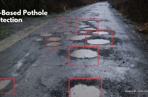
AI-Based Pothole Detection for Enhanced Road Safety
Potholes are a major safety hazard on roads. They can cause damage to vehicles, lead to accidents, and even injure or kill people. Traditional methods of pothole detection, such as manual inspection and visual surveys, are time-consuming and labor-intensive. They can also be inaccurate, especially in large or remote areas. AI-based pothole detection is a promising new technology that can help to improve road safety. These systems use cameras, sensors, and machine learning algorithms to automatically detect and identify potholes. It can be deployed in a variety of ways, including: Fixed Cameras: Fixed cameras can be installed at strategic locations along roads to monitor for potholes. These cameras can send alerts…
-
The Power of CSR Platforms: Driving Social Impact through Collaboration
In today’s interconnected world, businesses are increasingly recognizing the importance of corporate social responsibility (CSR). With growing environmental and social challenges, organizations are actively seeking ways to contribute positively to society. One powerful tool that has emerged to facilitate these efforts is the CSR platform. In this blog post, we will explore what a CSR platform or CSR System is and how it can empower businesses to drive social impact through collaboration. Defining the CSR Platform: A CSR platform is a digital solution that enables organizations to manage, track, and enhance their CSR initiatives effectively. It serves as a centralized hub where companies can connect with nonprofit organizations, social enterprises,…
-
Discover The Importance of Land Software in Land-Related Litigation Cases
Land management software plays a crucial role in managing land-related litigation cases. Here are some key points on the importance of Litigation management software in such cases: Efficient Case Management: Land dispute cases involve a large amount of documentation and paperwork. Land management software helps streamline case management by organizing and storing documents, tracking deadlines, and managing court dates. This ensures that all the relevant information is easily accessible, improving efficiency and reducing the chances of errors or missed deadlines. Centralized Information: Land-related litigation cases or land dispute cases often involve multiple parties, complex legal issues, and voluminous data. Litigation management software provides a centralized platform to store and access all the relevant information,…
-
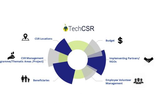
Leveraging Software-Based Beneficiary Tracking for Effective CSR Program Management
Corporate Social Responsibility (CSR) programs play a vital role in addressing social and environmental issues while creating positive impacts on communities. To ensure the success and efficiency of these programs, software-based beneficiary tracking systems have emerged as powerful tools for CSR program managers. By leveraging technology, these systems provide comprehensive solutions for managing, monitoring, and evaluating the impact of CSR initiatives. This blog will explore how the software-based beneficiary tracking system, TechCSR is revolutionizing CSR program management and driving positive change. Enhanced Data Management: One of the key advantages of a beneficiary tracking system is the ability to collect, organize, and analyze data more effectively. Traditional manual methods often struggle…
-
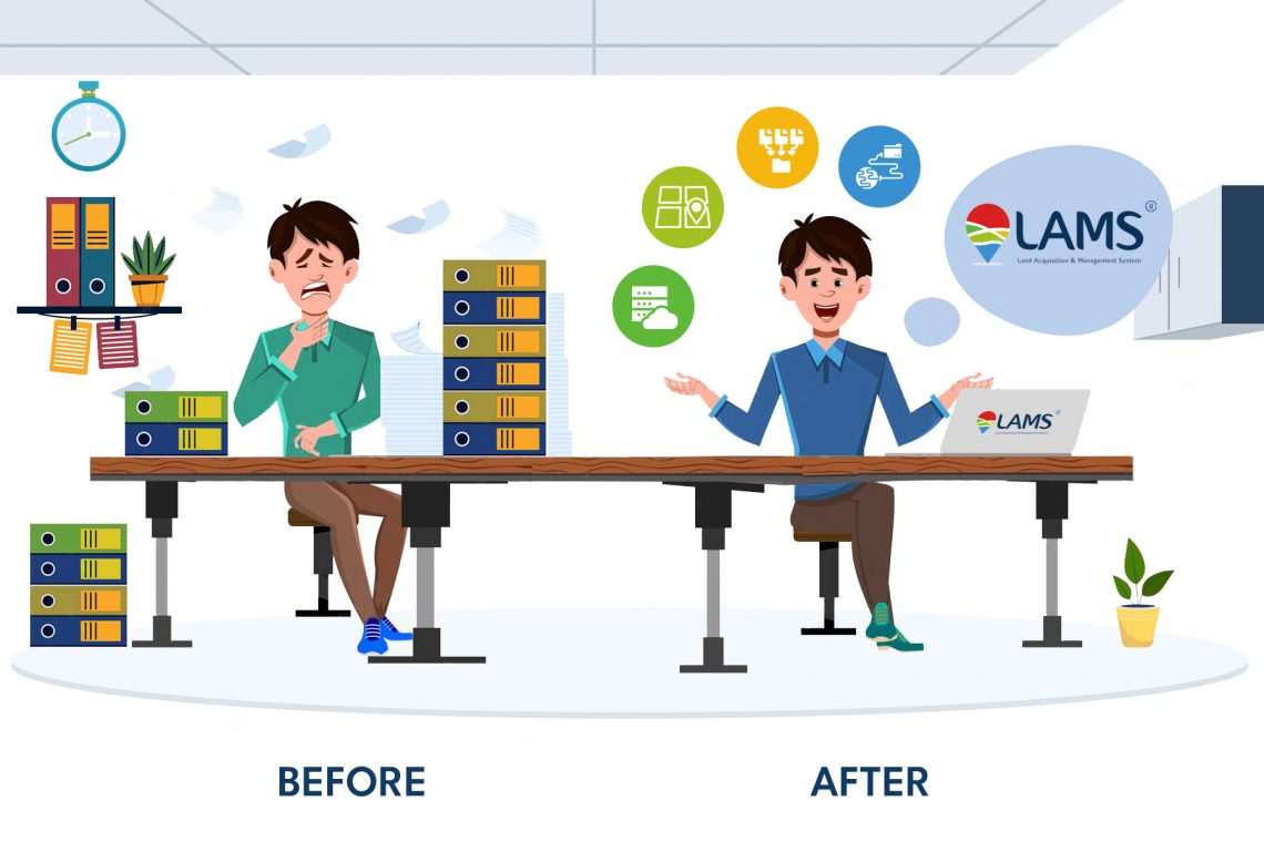
Things to Consider Before Buying a Land Management Platform:
The term “Land Asset Management System” (LAMS) refers to a software or information management system designed to streamline and manage the process of land acquisition. It is commonly used by government agencies, real estate developers, and infrastructure projects that involve acquiring land for various purposes, such as infrastructure development, urban planning, or conservation efforts. LAMS typically provides a centralized platform to track and manage the entire land acquisition lifecycle, including tasks such as land identification, negotiation, legal processes, compensation, and record keeping. Key features of a Land Acquisition Management System may include: Land Inventory: Maintaining a comprehensive inventory of available land parcels, including ownership details, boundaries, and other relevant information.…
-
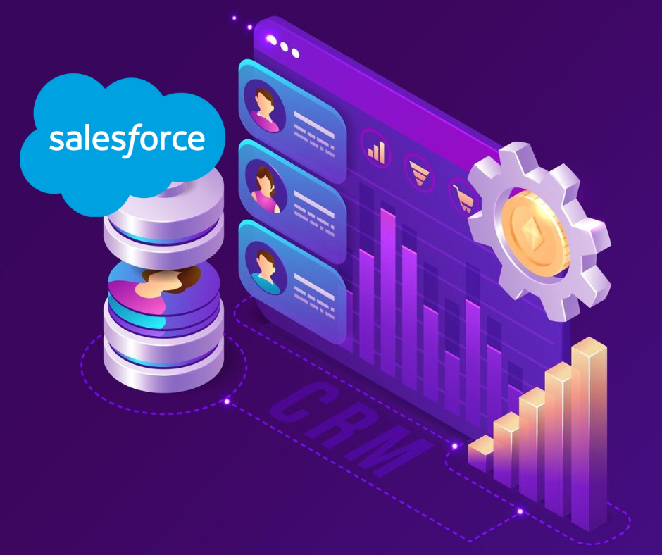
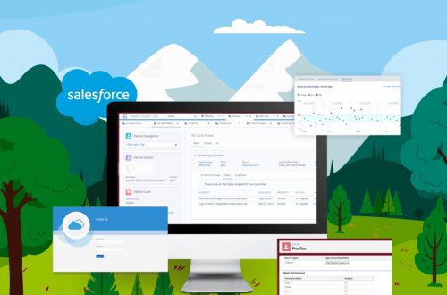
How Custom Salesforce Development Solutions Can Improve Your Business?
Are you looking for ways to improve your business processes, enhance your customer experience, and increase your revenue? In today’s fast-paced business environment, companies are constantly searching for ways to enhance their processes, improve their customer experience, and increase their revenue. Implementing Salesforce CRM and cloud services in the process can help businesses achieve these goals and more. Custom Salesforce Development refers to the process of tailoring Salesforce to meet a company’s unique needs. This involves building custom interfaces, automating tasks, and integrating Salesforce with other systems. The following are some of the ways in which custom Salesforce Development solutions can improve your business. Streamlined Processes By customizing Salesforce to your…
CyberSWIFT
Solutions With Innovative Future Technology