Urban Development
-
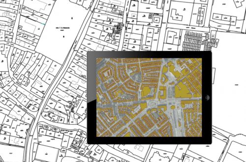
Urban Development Property Survey & Mapping: Powering Smart Cities with Precision
As cities continue to grow rapidly, efficient property administration and urban planning have become more crucial than ever. A property survey and mapping system acts as the foundation for sustainable urban development, facilitating everything from infrastructure planning to legal property ownership. By integrating cutting-edge technologies like Geographic Information Systems (GIS), Unmanned Aerial Vehicles (UAVs), and centralized digital property databases, municipalities and private developers can ensure accurate, transparent, and accessible property records. Let’s explore how this process works, why it’s essential, and how it’s shaping the future of smart cities. Why Property Survey & Mapping is Essential in Urban Development Inaccurate property boundaries, outdated property records, and unchecked encroachments have long hindered…
-
The Power of GIS in Urban Planning: A Comprehensive Overview
Urban planning is a dynamic and complex process that involves designing, organizing, and managing the physical, social, and economic aspects of cities. In the modern age, Geographic Information Systems (GIS) have emerged as a critical tool for urban planners, helping visualize, analyze, and manage city data efficiently. GIS allows city administrators to make data-driven decisions that shape sustainable, resilient, and smart urban environments. This blog explores how GIS technology is transforming urban planning by providing better data integration, infrastructure management, environmental analysis, and more. The Role of GIS in Urban Planning 1. Data Integration and Visualization GIS integrates various datasets, such as population demographics, land use maps, utility networks, and…
-
How Does a GIS-based Project Monitoring System Help in Road Construction Management?
A GIS (Geographic Information System) based project monitoring software can significantly enhance road construction monitoring management by leveraging geospatial data and analysis. Here are some ways in which GIS-based software helps in road construction management: Site Selection and Planning: GIS allows project managers to analyze various geographical factors such as terrain, soil types, land use, and environmental considerations. This aids in selecting suitable road construction sites and optimizing the project’s route and alignment. Data Integration: GIS-based software can integrate various data sources, including satellite imagery, drone surveys, LiDAR data, and ground-level data, into a single platform. This comprehensive dataset provides a holistic view of the project area and assists in…