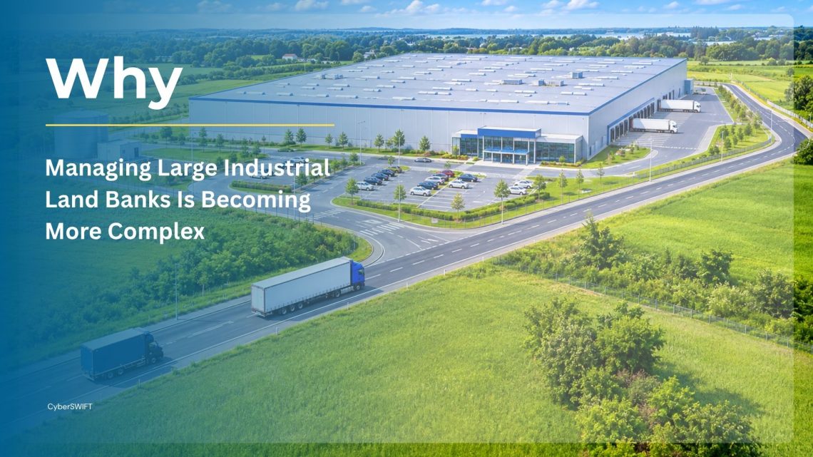
Why Managing Large Industrial Land Banks Is Becoming More Complex
Land is one of the most valuable strategic assets for industrial enterprises. Whether it is a manufacturing company expanding its production facilities, a mining organisation managing extensive operational territories, an infrastructure developer acquiring land for multiple projects, or an energy company establishing renewable energy installations, land availability and effective utilisation directly influence business growth.
However, managing large industrial land banks is considerably more complicated than simply acquiring plots and maintaining ownership records. Enterprises often manage hundreds or thousands of land parcels distributed across different geographical locations, involving multiple owners, legal agreements, acquisition stages, compensation records, regulatory approvals, leases and development plans.
As industrial operations expand, traditional land administration methods such as spreadsheets, physical registers, disconnected databases and manually maintained documents become increasingly difficult to manage. Information gets scattered across departments, ownership records become difficult to verify, acquisition progress loses visibility, and valuable land parcels may remain underutilised for years.
This is where industrial land management software becomes an important part of enterprise asset management. A centralised, GIS-enabled land bank management system enables organisations to manage the entire land lifecycle, from initial identification and acquisition to documentation, monitoring, allocation and final utilisation.
By combining Geographic Information Systems (GIS), Management Information Systems (MIS), document management and workflow automation, enterprises can establish a unified approach to managing their land assets while improving operational transparency, accountability and long-term planning.
1. Understanding Industrial Land Bank Management
An industrial land bank refers to the collection of land parcels owned, acquired, leased, allotted or otherwise controlled by an organisation for current operations and future business requirements.
These land assets may serve different purposes, including:
- Manufacturing plants and industrial facilities.
- Mining operations and mineral extraction areas.
- Warehouses, logistics hubs and distribution centres.
- Renewable energy projects, including solar and wind farms.
- Industrial corridors and infrastructure development.
- Employee housing and supporting facilities.
- Future expansion and strategic development.
Managing such a portfolio requires continuous coordination between land acquisition teams, legal departments, finance teams, surveyors, project managers and senior management.
A comprehensive industrial land bank management system helps bring these activities together by maintaining a centralised record of every land parcel, its ownership, geographical boundaries, legal status, acquisition history, associated documentation and current utilisation.
Rather than treating land as a collection of disconnected records, organisations can manage it as a strategic business asset throughout its lifecycle.
2. Major Challenges in Managing Large Industrial Land Banks
As the number of land parcels increases, the complexity of managing them grows. Several operational challenges can affect the efficiency, financial performance and compliance of industrial land portfolios.
2.1 Fragmented Land Records and Documentation
Industrial enterprises often maintain land information across multiple spreadsheets, physical files, departmental databases and independent document repositories.
Important information such as ownership details, plot measurements, sale deeds, mutation records, lease agreements, survey reports and compensation documents may be stored separately.
This creates several problems:
- Difficulty retrieving land records when required.
- Duplicate or inconsistent ownership information.
- Delays in verifying acquisition documentation.
- Limited visibility into the status of individual plots.
- Increased risk of missing or outdated records.
A centralised land records management software for enterprises can consolidate these records into a structured digital repository, allowing authorised users to access relevant information without depending on multiple disconnected sources.
2.2 Complex Land Acquisition Across Multiple Locations
Large industrial projects frequently require land acquisition across multiple villages, districts or geographical regions. Each location may involve different landowners, ownership structures, compensation requirements, administrative procedures and regulatory conditions.
Managing these activities manually makes it difficult to monitor:
- Total land required versus land acquired.
- Landowner identification and verification.
- Consent and agreement status.
- Compensation disbursement.
- Pending documentation.
- Acquisition progress against project timelines.
An integrated land acquisition management software solution helps organisations track acquisition activities at the individual plot, village and project levels.
It also enables management teams to identify acquisition bottlenecks and take corrective action before they affect project schedules.
2.3 Ownership Disputes and Legal Complications
Industrial land banks may include parcels with complicated ownership histories, multiple stakeholders, inheritance claims, disputed boundaries and pending litigation.
Without a reliable record of ownership and legal documentation, organisations may face difficulties establishing clear land titles or resolving disputes.
Some common issues include:
- Multiple ownership claims.
- Incomplete land transfer records.
- Inherited ownership and family-related claims.
- Boundary discrepancies.
- Pending court cases and litigation.
- Expired or disputed lease agreements.
A structured land management platform can maintain ownership histories, associated legal documents, stakeholder information and litigation status against individual land parcels.
This improves legal visibility and helps organisations identify potential risks before allocating land for new projects.
2.4 Limited Visibility into Land Utilisation
One of the biggest challenges for enterprises is understanding how much of their existing land bank is actually being utilised.
An organisation may own or control thousands of acres, but without consolidated information, it may struggle to identify:
- Land currently used for industrial operations.
- Vacant or unused parcels.
- Land reserved for future expansion.
- Encroached or inaccessible properties.
- Land under litigation or legal restrictions.
- Parcels available for lease, development or reassignment.
A land asset management software platform can help classify land according to its current status and intended purpose.
This enables organisations to make more informed decisions about land allocation, expansion and resource optimisation.
2.5 Encroachment and Boundary Monitoring
Large land banks are particularly vulnerable to unauthorised occupation, boundary disputes and gradual encroachment.
When land parcels are spread across remote or geographically dispersed locations, physically monitoring every property becomes expensive and time-consuming.
Traditional inspections may not identify unauthorised activities until significant damage has occurred.
GIS-based mapping, satellite imagery, field verification and geospatial monitoring can help organisations compare recorded boundaries with actual ground conditions and identify potential changes.
An integrated GIS land management software solution can provide a spatial overview of land parcels and support faster identification of boundary-related issues.
2.6 Inefficient Lease and Land Agreement Management
Industrial enterprises may have numerous land parcels under different lease arrangements, agreements and contractual obligations.
Managing these agreements manually can result in missed renewal dates, delayed payments, incomplete records and difficulties tracking contractual conditions.
A digital land management platform can maintain:
- Lease commencement and expiry dates.
- Landowner and lessee information.
- Agreement copies and supporting documents.
- Lease payment schedules.
- Renewal and termination status.
- Land allotment and transfer history.
This helps organisations maintain better control over contractual obligations and avoid unnecessary administrative complications.
2.7 Lack of Real-Time Management Information
Senior management needs accurate information to understand the overall condition of an industrial land portfolio.
However, when different departments maintain independent records, preparing consolidated reports can require significant manual effort.
Management may struggle to answer important questions:
- How much land has been acquired for a particular project?
- How many acres are currently available?
- Which parcels have pending legal issues?
- What is the total compensation paid and outstanding?
- Which land parcels are currently underutilised?
- How much land is ready for future development?
An enterprise land management software platform with integrated dashboards and reporting capabilities can provide a consolidated view of land-related activities, supporting faster and more informed decision-making.
3. From Acquisition to Utilisation: The Complete Industrial Land Management Lifecycle
Effective land bank management requires a structured approach that covers every stage of the land lifecycle. Organisations should not consider acquisition as the final objective. The real value comes from ensuring that every acquired parcel is properly documented, protected, monitored and utilised.
3.1 Land Identification and Requirement Assessment
The first stage involves identifying suitable land parcels based on the organisation’s operational and strategic requirements.
For industrial development, this may include evaluating:
- Geographical location and accessibility.
- Proximity to roads, railways, ports and logistics networks.
- Availability of utilities and supporting infrastructure.
- Land ownership and title conditions.
- Topography and physical suitability.
- Environmental and regulatory restrictions.
- Future expansion requirements.
GIS-based land management software helps visualise potential land parcels on interactive maps, enabling teams to analyse their location, boundaries and surrounding geographical features.
Spatial information can also be integrated with satellite imagery, survey data and external geospatial datasets to support better site-selection decisions.
3.2 Land Acquisition Planning and Execution
Once suitable parcels have been identified, organisations initiate the acquisition process.
This stage involves identifying landowners, verifying ownership, conducting surveys, preparing acquisition proposals, managing negotiations and tracking compensation.
A centralised land acquisition and management system can streamline these workflows by recording the status of each plot and maintaining a complete history of acquisition-related activities.
Key capabilities include:
- Plot-wise acquisition tracking.
- Landowner and ownership information.
- Family tree and stakeholder mapping.
- Survey and verification records.
- Acquisition status monitoring.
- Compensation calculations and disbursement tracking.
- Supporting document management.
- Approval workflows and activity history.
With a structured acquisition management process, organisations can monitor progress across multiple locations and identify delays before they affect overall project execution.
3.3 Digital Land Records and Document Management
After acquisition, maintaining accurate and accessible records becomes essential.
Every land parcel should have a unique digital record containing its relevant ownership, geographical, legal and financial information.
A comprehensive land document management software solution can help organisations digitise and organise:
- Sale deeds and conveyance deeds.
- Land ownership records.
- Mutation and registration documents.
- Survey and measurement reports.
- Land acquisition notifications.
- Compensation and payment records.
- Lease and allotment agreements.
- Court orders and legal correspondence.
Documents can be associated with specific plots, villages, owners or projects, making retrieval and verification easier.
Role-based access can further ensure that sensitive land and ownership information is accessible only to authorised users.
3.4 GIS-Based Land Mapping and Spatial Visualisation
Managing large industrial land banks requires more than maintaining textual records. Organisations also need to understand the exact geographical location, extent and spatial relationships of their land parcels.
This is where GIS technology becomes particularly valuable.
A GIS land management software platform can represent individual plots as mapped geographical features, allowing users to visualise land boundaries and associated information through an interactive map interface.
Important capabilities include:
- Plot-wise boundary visualisation.
- Village and administrative boundary mapping.
- Geo-referenced land records.
- Spatial measurement and area calculation.
- Overlay of satellite imagery.
- Infrastructure and utility mapping.
- Identification of adjoining and overlapping parcels.
- Integration with DGPS and Total Station survey data.
Organisations can also incorporate geospatial datasets from sources such as NRSC, Planet, Maxar and Airbus, subject to data availability and licensing.
The integration of GIS and land records creates a spatially enabled land information system that makes complex land portfolios easier to understand and manage.
3.5 Land Allotment and Internal Allocation
After acquisition and documentation, land parcels may need to be allocated to different business units, operational facilities, infrastructure projects or development activities.
Without a centralised allocation mechanism, organisations may face overlapping allotments, unclear responsibilities and difficulties tracking the intended use of individual plots.
A land bank management system can maintain allocation records, including:
- Allotted land area and plot details.
- Department or project receiving the allocation.
- Allocation purpose and approval details.
- Allotment date and supporting agreements.
- Current allocation status.
- Transfer or reassignment history.
This creates a transparent record of how land assets are distributed across an organisation.
3.6 Continuous Land Monitoring and Protection
Land monitoring should continue even after acquisition and allocation.
Organisations need to ensure that their land assets remain protected and that actual ground conditions correspond with recorded information.
A GIS-enabled land asset management software solution can support continuous monitoring through:
- Periodic field inspections.
- Mobile-based geographical verification.
- GPS-enabled location capture.
- Encroachment identification.
- Boundary verification.
- Satellite imagery comparison.
- Field photographs and inspection reports.
- Issue reporting and resolution tracking.
Mobile GIS applications are particularly useful for field teams responsible for inspecting geographically dispersed land parcels.
They can capture location-specific information and update centralised records, reducing dependence on paper-based reporting.
3.7 Land Utilisation Planning and Optimisation
Acquisition alone does not guarantee that land assets are being used efficiently.
Organisations must regularly assess whether their existing land bank is supporting current operations and future business requirements.
A land utilisation management system can help classify parcels according to their actual and planned usage.
For example:
| Land classification | Management purpose |
| Operational land | Currently used for industrial activities |
| Under development | Construction or infrastructure work in progress |
| Vacant land | Available but not currently utilised |
| Reserved land | Allocated for future expansion |
| Leased land | Given to third parties under lease arrangements |
| Disputed land | Ownership or legal matters pending |
| Encroached land | Requires verification and corrective action |
| Restricted land | Subject to legal or regulatory limitations |
This classification helps management identify land that may be available for productive use, requires further development or needs legal intervention.
With accurate utilisation information, organisations can reduce unnecessary new acquisitions and make better use of their existing land resources.
4. Why GIS-Based Industrial Land Management Software Is Essential
Traditional land administration systems primarily focus on storing documents and maintaining textual records. However, industrial land management involves a strong geographical component.
A parcel’s location, boundary, surrounding infrastructure, accessibility and relationship with neighbouring properties can significantly influence its business value.
GIS technology adds a spatial dimension to enterprise land management.
Key advantages of GIS-based land management
Centralised spatial database: Maintain land parcel boundaries, ownership details and associated records in a unified geographical database.
Better land visibility: Visualise large industrial land banks through interactive maps instead of relying entirely on spreadsheets and static maps.
Improved survey accuracy: Integrate GPS, DGPS and Total Station survey information to support accurate boundary mapping and verification.
Spatial analysis: Identify overlapping parcels, neighbouring properties, accessibility constraints and geographical relationships.
Encroachment monitoring: Compare recorded land boundaries with field observations and available satellite imagery to identify potential unauthorised occupation.
Better planning: Analyse vacant, operational, leased and reserved land to support informed utilisation and expansion decisions.
By combining spatial intelligence with management information, enterprises can move towards a more integrated approach to land asset administration.
5. The Role of Automation and Data Integration in Enterprise Land Management
Large industrial organisations rarely operate through a single software platform. Land-related information may be distributed across ERP, SAP, CRM, finance, project management and document management systems.
A standalone land management platform can create another information silo unless it is designed to integrate with existing enterprise applications.
An integrated enterprise land management software solution can connect land-related workflows with other organisational systems.
5.1 ERP and SAP Integration
Integration with ERP and SAP platforms can help synchronise relevant financial, project and asset-related information.
For example, organisations can connect land acquisition records with financial transactions, compensation payments, project budgets and asset records.
5.2 CRM and Stakeholder Management Integration
Land acquisition involves continuous interaction with landowners, representatives, government authorities and other stakeholders.
CRM integration can help organisations maintain stakeholder communication records and coordinate follow-ups with acquisition teams.
5.3 Financial and Compensation Management
Land acquisition involves substantial financial transactions, including landowner compensation, statutory payments, registration expenses and other associated costs.
Integrating land management workflows with financial systems can improve the visibility of payment status and project-wise acquisition expenditure.
5.4 Automated Workflow and Approval Management
Organisations can introduce structured approval workflows for acquisition proposals, land verification, allotment, compensation and legal documentation.
Automated notifications and status updates can help relevant teams take timely action and reduce administrative delays.
6. Key Features to Look for When Choosing Industrial Land Management Software
Selecting the right platform is important because large industrial land banks require a system that can accommodate complex workflows, extensive geographical coverage and multiple stakeholders.
Businesses evaluating industrial land management software should consider the following capabilities.
| Essential feature | Business value |
| Centralised land database | Consolidates records across locations |
| GIS-based plot mapping | Enables geographical visualisation |
| Land acquisition tracking | Monitors acquisition progress |
| Digital document management | Organises land-related documentation |
| Ownership management | Maintains ownership and stakeholder records |
| Compensation management | Tracks payments and outstanding amounts |
| Litigation management | Monitors disputes and legal cases |
| Encroachment monitoring | Supports land protection |
| Lease management | Tracks agreements and renewal dates |
| Land utilisation tracking | Identifies vacant and underutilised land |
| Mobile GIS application | Supports field-level data collection |
| MIS dashboards | Provides management-level visibility |
| ERP/SAP integration | Connects land data with enterprise systems |
| Role-based access control | Protects sensitive information |
| Customisable workflows | Adapts to organisational processes |
How to evaluate a land management software provider
Beyond feature availability, organisations should evaluate the software provider’s ability to understand and support their operational requirements.
Consider the following factors:
1. Scalability: Can the platform manage thousands of land parcels across multiple projects, states or countries?
2. Customisation: Can acquisition, compensation, allotment and utilisation workflows be configured according to organisational requirements?
3. GIS capabilities: Does the solution support accurate plot mapping, spatial analysis and geospatial data integration?
4. Integration capabilities: Can it connect with existing ERP, SAP, CRM and financial applications?
5. Mobile accessibility: Can field personnel collect and update land information directly from remote locations?
6. Data security: Does it offer appropriate access controls, data protection and deployment options?
7. Reporting and analytics: Can management generate consolidated reports and monitor project-wise land performance?
8. Implementation expertise: Does the provider have experience handling complex industrial land acquisition and management workflows?
The right solution should not simply digitise existing registers. It should establish a connected operational framework for managing the entire land lifecycle.
7. How Effective Land Bank Management Improves Industrial Business Performance
A well-implemented land management platform can create value across several operational and strategic areas.
Reduced Land Acquisition Delays
Centralised acquisition tracking helps teams identify pending activities, documentation gaps and approval bottlenecks, improving coordination across different locations.
Better Utilisation of Existing Assets
Accurate land classification helps organisations identify vacant, available and underutilised parcels before considering additional acquisitions.
Improved Legal and Regulatory Visibility
Digital ownership records, legal documentation and litigation tracking help organisations monitor compliance-related requirements and identify potential risks.
Reduced Administrative Workload
Automated workflows, digital records and centralised reporting reduce repetitive manual tasks and dependence on disconnected spreadsheets.
Greater Transparency and Accountability
Plot-wise activity histories, approval records and role-based access improve traceability across acquisition, allotment and utilisation activities.
Data-Driven Expansion Planning
GIS mapping and consolidated land information enable management to assess existing land availability before planning new facilities or expansion projects.
Better Cross-Departmental Coordination
A common platform allows acquisition, legal, finance, GIS and project teams to work with consistent land-related information.
Ultimately, industrial land management software helps organisations transition from fragmented land administration towards structured, measurable and information-driven asset management.
8. How CyberSWIFT LAMS Contributes to Smarter Industrial Land Bank Management
Managing extensive industrial land portfolios requires a specialised platform that understands the relationship between land acquisition, geographical information, ownership records, documentation, legal workflows and utilisation.
CyberSWIFT’s Land Acquisition & Management System (LAMS) is designed to help organisations digitise, centralise and manage their land-related operations through an integrated GIS and MIS platform.
Rather than managing acquisition records, spatial data and land documentation through separate systems, LAMS brings these functions together within a unified land management environment.
8.1 Centralised Land Bank Management
LAMS enables organisations to maintain structured digital records of land parcels across multiple locations and projects.
Teams can access relevant plot information, ownership details, geographical records, documents and acquisition status through a centralised system.
This helps establish a consistent information repository for managing extensive industrial land banks.
8.2 End-to-End Land Acquisition Management
LAMS supports land acquisition workflows, from initial land identification and ownership verification to acquisition progress monitoring and compensation management.
Organisations can maintain plot-wise and location-wise information to track acquisition activities and identify pending requirements.
8.3 GIS-Based Land Parcel Visualisation
Through GIS integration, LAMS enables users to visualise land parcels and their boundaries on interactive maps.
Organisations can associate spatial information with ownership records, survey data and relevant documents, making it easier to understand the geographical distribution of their land assets.
8.4 Ownership and Family Tree Management
Complex industrial land acquisition often involves multiple owners and inherited ownership structures.
LAMS supports ownership and family tree management, helping organisations maintain structured information about landowners and associated stakeholders.
8.5 Digital Document Management
LAMS provides a centralised approach to managing land-related documentation.
Relevant records can be associated with individual plots and acquisition activities, making it easier for authorised teams to retrieve and review information.
8.6 Compensation and Financial Tracking
Land acquisition involves multiple compensation-related activities.
LAMS supports the management of landowner compensation and associated land, crop and asset information, helping organisations maintain visibility into acquisition-related financial workflows.
8.7 Litigation and Encroachment Management
LAMS supports the tracking of land-related legal cases and encroachment information.
By maintaining plot-linked records, organisations can improve visibility into disputed or potentially vulnerable land parcels and coordinate appropriate follow-up activities.
8.8 Mobile-Based Field Data Collection
Field teams can use mobile GIS capabilities to collect location-based information, conduct land verification and update relevant records.
This helps connect field-level activities with centralised land management operations.
8.9 Customisable Workflows and Enterprise Integration
Different industrial organisations follow different acquisition, approval and land administration processes.
LAMS supports configurable workflows and can be integrated with enterprise applications such as SAP, ERP and CRM systems based on project requirements.
This makes it possible to align land management activities with broader organisational operations.
8.10 MIS Dashboards and Management Reporting
LAMS provides management-level visibility into land acquisition and administration through consolidated information and reporting.
Decision-makers can monitor relevant land records, acquisition progress, legal status and other operational information to support better planning and coordination.
From acquiring individual plots to managing extensive industrial land banks, CyberSWIFT LAMS helps organisations establish a more structured, connected and GIS-enabled approach to land management.
9. Industries That Can Benefit from Industrial Land Bank Management Software
Although land bank management is relevant to several sectors, it is particularly important for industries that manage extensive geographical assets and land-intensive operations.
| Industry | Key land management requirements |
| Manufacturing | Industrial plots, factory land, expansion planning and land allotment |
| Mining and Metals | Mining lease boundaries, land acquisition, ownership and encroachment monitoring |
| Infrastructure | Land acquisition, Right of Way (RoW), compensation and project-wise land tracking |
| Renewable Energy | Solar and wind project land identification, acquisition and utilisation |
| Oil and Gas | Pipeline corridors, lease management, land rights and operational boundaries |
| Cement | Limestone mining areas, factory land and supporting infrastructure |
| Logistics and Warehousing | Warehouse locations, land allocation and property portfolio management |
| Industrial Parks | Plot allotment, occupancy, lease management and infrastructure planning |
For these sectors, an integrated land management system can help coordinate land-related activities across geographically distributed projects and business units.
10. The Future of Industrial Land Management: AI, GIS and Intelligent Asset Planning
The future of industrial land management will increasingly depend on the integration of geospatial intelligence, automation, artificial intelligence and enterprise data.
As organisations manage larger and more complex land portfolios, conventional record-keeping systems will become less effective in supporting real-time decision-making.
Several emerging technologies are expected to influence how enterprises manage their land assets.
Artificial Intelligence for Land Data Analysis: AI can help extract relevant information from land documents, identify important data points and support natural-language queries across structured databases and document repositories.
Satellite Imagery and Remote Sensing: Satellite imagery can support periodic monitoring of land boundaries, land-use changes, surrounding development and potential encroachment.
Predictive Land Utilisation: Historical acquisition and utilisation data can help organisations identify patterns, assess available land and support future development planning.
Mobile GIS and Field Automation: Mobile applications will continue to improve communication between field teams and centralised land administration systems.
Integrated Enterprise Intelligence: Connecting GIS, MIS, ERP and financial information will help organisations develop a more comprehensive understanding of their land portfolios.
These developments will move industrial land management beyond simple digital record maintenance towards intelligent, data-driven land asset planning.
Conclusion: Transforming Industrial Land Banks into Strategic Business Assets
Managing large industrial land banks is a continuous process that extends far beyond acquiring properties and maintaining ownership documents. It requires a coordinated approach to acquisition, documentation, legal management, geographical monitoring, allocation and utilisation.
When these activities are handled through disconnected systems, organisations risk losing visibility into their land assets, increasing administrative complexity and missing opportunities to optimise existing resources.
Implementing an integrated industrial land management software platform helps enterprises establish a centralised and structured approach to managing their entire land portfolio.
With GIS-based mapping, digital documentation, acquisition tracking, ownership management, compensation monitoring and utilisation reporting, organisations can gain better control over their land assets and make more informed operational decisions.
CyberSWIFT’s Land Acquisition & Management System (LAMS) brings these capabilities together through an integrated GIS and MIS platform designed to support complex land acquisition and management requirements.
Whether an organisation is managing an expanding industrial land bank, acquiring land for a new infrastructure project or monitoring thousands of geographically distributed parcels, LAMS can help transform fragmented land records into a connected and actionable land information system.
Looking to streamline your industrial land acquisition and management processes?
Explore how CyberSWIFT LAMS can help your organisation manage land assets more efficiently.
Frequently Asked Questions (FAQs)
1. What is industrial land bank management?
Industrial land bank management is the process of identifying, acquiring, documenting, monitoring, allocating and optimising land parcels owned or controlled by an industrial organisation. It involves managing ownership records, geographical boundaries, legal documentation, acquisition status and actual land utilisation.
2. What is industrial land management software?
Industrial land management software is a digital platform that helps organisations manage their land assets throughout the acquisition and utilisation lifecycle. It typically includes GIS mapping, land records management, ownership tracking, document management, compensation monitoring, lease administration and reporting capabilities.
3. How does land bank management software help large enterprises?
Land bank management software centralises information about land parcels across multiple locations and projects. It improves visibility into acquisition progress, ownership, legal status, documentation, encroachment and land utilisation while reducing manual administrative work.
4. Why is GIS important in industrial land management?
GIS enables organisations to visualise land parcels geographically, analyse plot boundaries, integrate survey information and monitor spatial changes. It helps connect geographical information with ownership, legal and operational records, making land administration more effective.
5. How can organisations improve industrial land utilisation?
Organisations can improve land utilisation by maintaining accurate parcel-level records, classifying land according to its current status, identifying vacant and underutilised properties, monitoring development progress and using GIS-based analysis to support future allocation and expansion decisions.
6. What features should businesses look for in land acquisition management software?
Businesses should look for plot-wise acquisition tracking, ownership management, digital document storage, GIS mapping, compensation tracking, litigation management, encroachment monitoring, mobile field applications, workflow automation and MIS reporting.
7. Can land management software integrate with SAP and ERP systems?
Yes. Enterprise land management platforms can integrate with SAP, ERP, CRM and other organisational applications through suitable APIs and integration mechanisms. This helps synchronise relevant land, financial, project and stakeholder information.
8. How does CyberSWIFT LAMS support industrial land bank management?
CyberSWIFT LAMS provides an integrated GIS and MIS-based platform for managing land acquisition, ownership, documentation, compensation, litigation, encroachment, field-level activities and land-related reporting. It helps organisations centralise land information and manage complex land-related workflows.

Darshana Mukherjee is a Senior Consultant in Business Development with over 11 years of experience in sales, primarily focused on the Geospatial IT industry. Her expertise lies in driving business growth through strategic partnerships, client engagement, and delivering solutions. She combines her technical knowledge with business acumen to contribute effectively to organizational success.
Darshana Mukherjee
Darshana Mukherjee is a Senior Consultant in Business Development with over 11 years of experience in sales, primarily focused on the Geospatial IT industry. Her expertise lies in driving business growth through strategic partnerships, client engagement, and delivering solutions. She combines her technical knowledge with business acumen to contribute effectively to organizational success.

You May Also Like

Advantages of AI and GIS-Driven Compensatory Land Allocation System
Land Records Management System Using GIS Technology