The Evolving Landscape of Land Management: Harnessing Technology for Sustainable Growth
As global challenges around land use intensify, the field of land management is undergoing significant transformation. Technology is playing a pivotal role in this evolution, offering innovative solutions to optimize land use, enhance productivity, and promote sustainable growth. From geographic information systems (GIS) and satellite imagery to advanced land management software and drones, these tools are enabling more efficient, informed, and environmentally conscious decision-making. This article explores ahow the integration of technology in land management practices is reshaping the future of sustainable land use and fostering a more balanced approach to development and conservation.
Understanding Land Management Software: A Modern Necessity
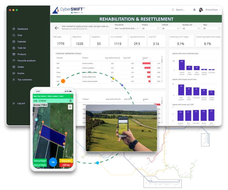
Land management software serves as a centralized platform for managing land-related data and processes. It streamlines tasks such as tracking land ownership, monitoring land use, and ensuring compliance with regulatory frameworks. By integrating advanced technologies like Geographic Information Systems (GIS) and data analytics, this software enables organizations to make informed decisions that balance development with sustainability.
The software’s capabilities extend beyond traditional land administration methods, offering tools for planning, zoning, and environmental impact assessments. These features are essential for optimizing land use, particularly in rapidly urbanizing areas where competing demands on land resources must be carefully managed.
Key Features of Land Management System: Building Blocks for Efficiency
- Comprehensive Data Management: The core of land management software lies in its ability to store and organize vast amounts of land-related information. This includes cadastral data, ownership records, zoning regulations, and environmental impact assessments. Efficient data management ensures that decision-makers have access to accurate and up-to-date information, reducing the risk of errors and enabling more effective land use planning.
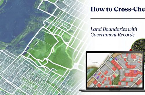
- GIS Integration: The integration of GIS technology allows for the visualization and analysis of spatial data. This feature is crucial for tasks such as mapping land parcels, assessing land use patterns, and conducting environmental impact studies. GIS tools provide a spatial context to data, making it easier to understand the implications of different land use scenarios.
- Automated Workflow Management: Land management system automates routine tasks, such as document approvals, title issuance, and tax assessments. This automation not only increases efficiency but also reduces the likelihood of human error. Automated workflows ensure that critical tasks are completed on time, preventing delays in land development projects.
- Environmental Impact Assessment Tools: Includes tools for assessing the environmental impact of land use changes, supporting sustainable development practices.
- Land Record Management: Digitizes and centralizes land records, ensuring easy access, management, and updating of land ownership and transaction data.
- Survey and Mapping Tools: Provides tools for conducting land surveys and creating accurate digital maps, essential for planning and development purposes.
- Enhanced Collaboration and Communication: Effective land management often involves multiple stakeholders, including government agencies, developers, and environmental groups. Land management software facilitates collaboration by providing a shared platform for communication and data sharing. This transparency ensures that all parties are aligned in their efforts to manage land resources responsibly.
- Compliance and Regulation Management: Ensures that all land-related activities comply with local, regional, and national regulations, helping users avoid legal complications.
- User Access Control and Security: Protects sensitive land data with robust security measures and customizable access controls, ensuring that only authorized users can view or modify information.
- Mobile Access and Field Data Collection: Supports mobile devices for field data collection and real-time access to information, enhancing on-site efficiency and decision-making.

The Role of Land Management Software in Sustainable Development
Sustainable development hinges on the careful balancing of economic, social, and environmental factors. Land Management System plays a critical role in this process by providing the tools necessary for informed decision-making. Whether it’s planning a new urban development, managing agricultural land, or conserving natural habitats, the software ensures that all land-related activities are aligned with sustainability principles.
For instance, in urban areas, the software can help planners identify the most suitable locations for new housing or infrastructure projects, considering factors such as land availability, environmental impact, and zoning regulations. In rural settings, it can aid farmers in optimizing land use for agricultural production while minimizing environmental degradation.
Future Trends in Land Management Software: Embracing Innovation
The field of land management software is constantly evolving, with new technologies and approaches emerging to address the challenges of the modern world. Some of the key trends shaping the future of land software include:
Blockchain for Land Records: Blockchain technology offers a secure and transparent way to manage land ownership records. By creating a tamper-proof ledger of land transactions, blockchain can reduce fraud and increase trust in land administration systems.
AI and Machine Learning: Artificial intelligence (AI) and machine learning algorithms are being integrated into land management software to enhance decision-making. These technologies can analyze large datasets to predict land use trends, identify potential risks, and suggest optimal land management strategies.
Cloud-Based Solutions: Cloud computing is making land management software more accessible and scalable. Cloud-based platforms allow users to access data and tools from anywhere, facilitating collaboration and enabling real-time updates to land records.
Mobile Accessibility: Mobile applications are becoming an essential component of land management system, allowing users to collect and update data in the field. This real-time data collection improves the accuracy of land records and speeds up decision-making processes.

Paving the Way for Sustainable Land Stewardship
As the demands on land resources continue to grow, the need for effective land management solutions becomes increasingly critical. Land management software offers a powerful tool for organizations seeking to navigate the complexities of land administration while promoting sustainable development. By embracing the latest technological advancements, this software is helping to ensure that our land resources are managed responsibly, paving the way for a more sustainable future.

Darshana Mukherjee is a Senior Consultant in Business Development with over 11 years of experience in sales, primarily focused on the Geospatial IT industry. Her expertise lies in driving business growth through strategic partnerships, client engagement, and delivering solutions. She combines her technical knowledge with business acumen to contribute effectively to organizational success.


