Field Data Acquisition System

It is a web-based GIS application along with workforce tracking and field data acquisition system. The application provides geospatial layer theming, adding dynamic geospatial data for a point layer. It has the facility of dynamic form building which will be used in mobile applications for data entry. The dynamic forms can be related to a point layer and point layers can be searched on geospatial data and can be analyzed by the form data. It has the facility of mobile user tracking along with the plotting of survey forms on the tracking path of the particular user. It provides notifications for mobile user form entry. It supports both current and historical data of tracking of mobile users.
a mobile application FDAS( Form Data Acquisition Software ) is integrated with the web application

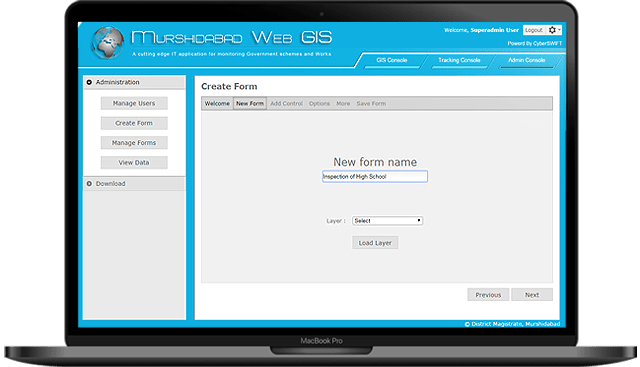
Dynamic Form Building

Build Your Own Form

  • The application provides dynamic form building facility for survey purpose. The form can link with point layers to get survey data for a particular point. A mobile application FDAS( Form Data Acquisition Software ) is integrated with the web application. With the help of this mobile application users can fill up forms and submit it to the central server. Along with the data, relevant images, and longitude and latitude value of the location from where the form has been submitted can also be updated. The entire service has a strong security and user management system.
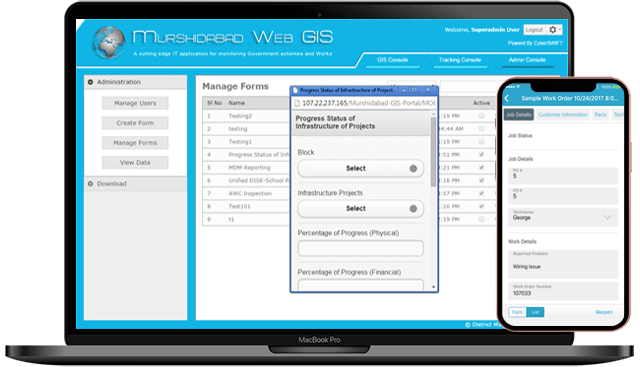
a dynamic form on mobile and webgis portal

Mobile View Of Dynamic Form

Confirm Your Generated Form

  • There is a facility to view the created dynamic form. Application provides a interface to see how the dynamic form will look in the mobile. User can check and verified the created form.
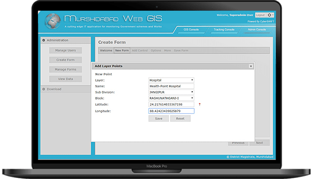
application shows the facility of adding new points to a point layer

Point Adding To Layer

Add Points to Layers

  • The application provides facility of adding new points to a point layer. Just choose a point layer and provide name and area information and choose a point from map and save. A new point will be ready for analysis.
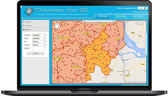
web gis portal for polygon layer searching, zooming into the area

Area Searching

Find Your Region of Interest

  • The application provides area searching facility i.e. polygon layer searching. If a search is for a particular region is done, the application highlighted that particular area and zooming into the area.
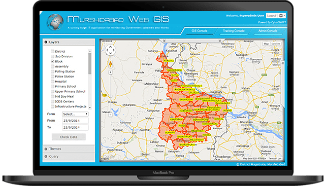
map of murshidabad of applying GIS layers, polygon and point layers

GIS Layer Theming

Customise Your Layer

  • The application provides geospatial layer theming. It has the facility to show polygon and point layers. Multiple layers can be shown at a time. It provides facility of user wise custom layer theming.
gis app showing both tracking & survey data of particular users

Tracking With Survey Data

Analyse Your Field Survey

  • The application provides the facility of workforce tracking. It shows both tracking and survey data of a particular users. It supports notification when the tracked mobile user submit a new form. It supports both current and history of tracking and form data entered by mobile user.
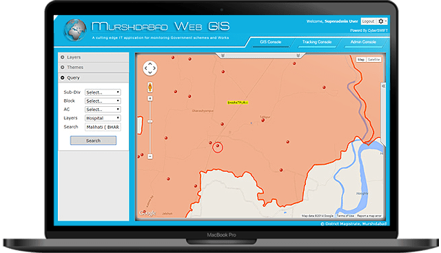
application shows location searching facility i.e. point layer searching

Point Searching

Find Your Location of Interest

  • The application provides location searching facility i.e. point layer searching. A auto complete box helps the user to enter the location that he/she wants to search. The application zoom in to that particular location and shows a circle by making the point as center of it.

Contact Us

Let’s Have a Conversation

We would love to learn about your business challenges and goals, and share insights about how we can possibly help you using Field Data Acquisition System. We would also be happy to show you some of the ways we’ve helped customers to get where they wanted to go.