Conversion of raster image to vector layer, known as Vectorization is one of the basic services comes under GIS map making activities. As a company CyberSWIFT started its India operation since 1998 mainly in terms of map conversion and digitization. In more than last 15 years, we have successfully completed similar kind of work for significant no. of Govt., Semi-Govt. and private organizations under multiple projects. We have a dedicated and experienced technical team with proficiency in GIS software who can understand the need of the client to deliver the output under tightest of deadline without compromising the quality standard.
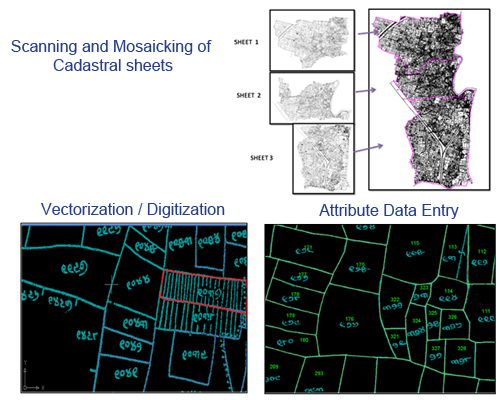
In general, the vectorization process starts with scanning of paper copy maps, drawings, cadastral sheets, utility plans etc. to get it converted in to digital format. Depending on the necessity stitching and mosaicking of adjacent images have been done followed by conversion of images in to vector layers represented as point, line and polygon objects. For conversion of images to vector layers we use advanced GIS software platform including ArcGIS, MapInfo, AutoCAD Map etc. to deliver output in universally acceptable GIS file format as per client's requirements.
Please go through few of our basic service :

Cadastral sheet digitization is one of the most common type of map conversion activity comes under GIS services. The overall process involves series of activities starting from scanning of existing mouza sheets, stitching, mosaicking of adjacent sheets, vectorization of raster image in to multiple vector layers like village boundary, sheet boundary, plot boundary, road, nallas, other existing objects and incorporation of all available attributes like village details, sheet no., plot no. etc.

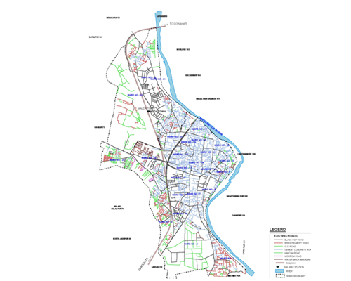
Availability of old paper copy maps as urban/ town plan and utility are very common in developing country like India. Thus, for all urban bodies, conversion of those existing maps in to digital and editable format become essential for their day-to-day infrastructure maintenance, utility services and future plans.
Digital conversion of all existing maps/ drawings etc. added with partial field verification can produce useful digital map including vector layers like urban boundary, ward boundary, land use, transportation network, drainage & sewages, water supply network, important land marks, other various infrastructures etc.
Utilizing digitized vectors in association with information from other sources like CyberSWIFT started its India operation since 1998 mainly in terms of socio-economical survey etc. thematic mapping can be done for various departments of urban body for their future planning. For example, identification of slum area and necessary infrastructure can be thematically represented utilizing digital map along with socio-economical data of that area.
Under this service, we have successfully completed significant no. of map making activities mainly for municipalities and other urban bodies.

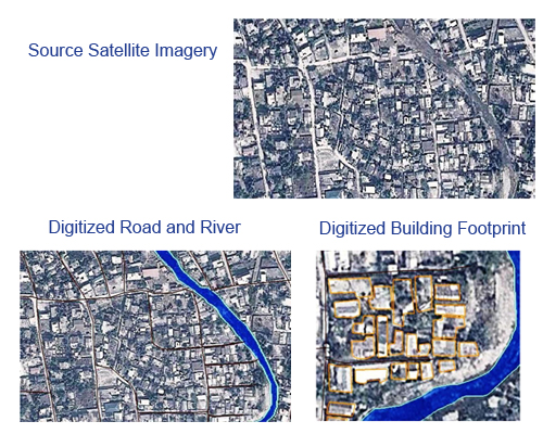
We have adequate experiences and skill set to identify features and extract vector layers for wide range of features categories like land base, forest coverage, water body, transportation, habitation, building footprint etc. utilizing different types of Satellite Imageries through the process of vectorization.